Neuland | |
|---|---|
Location of Neuland | |
 Neuland  Neuland | |
| Coordinates: 53°28′16″N 10°1′29″E / 53.47111°N 10.02472°E | |
| Country | Germany |
| State | Hamburg |
| City | Hamburg |
| Borough | Harburg |
| Area | |
| • Total | 10.0 km2 (3.9 sq mi) |
| Population (2020-12-31)[1] | |
| • Total | 1,794 |
| • Density | 180/km2 (460/sq mi) |
| Time zone | UTC+01:00 (CET) |
| • Summer (DST) | UTC+02:00 (CEST) |
| Dialling codes | 040 |
| Vehicle registration | HH |
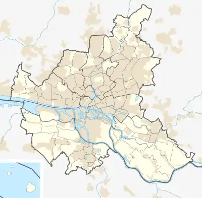
ⓘ is a quarter of Hamburg, Germany, in the borough of Harburg. It is located in the east of the borough below the Elbe river. In 2020 the population was 1,794.
Geography
Neuland borders the quarters Wilhelmsburg, Gut Moor and Harburg. It also borders the Landkreis Harburg in Lower Saxony.
History
Neuland became a part of Hamburg through the Greater Hamburg Act in 1937.
Politics
These are the results of Gut Moor and Neuland in the Hamburg state election:
| State Election | SPD | AfD | CDU | Greens | Left | FDP | Others |
|---|---|---|---|---|---|---|---|
| 2020 | 45,1 % | 13,1 % | 12,4 % | 12,0 % | 5,4 % | 5,1 % | 6,9 % |
| 2015 | 47,4 % | 11,5 % | 20,5 % | 4,2 % | 4,4 % | 8,0 % | 4,0 % |
| 2011 | 52,0 % | – | 26,2 % | 5,9 % | 4,4 % | 6,4 % | 5,1 % |
| 2008 | 36,7 % | – | 47,2 % | 6,4 % | 4,4 % | 3,4 % | 1,8 % |
| 2004 | 31,6 % | – | 50,8 % | 5,1 % | – | 2,2 % | 10,3 % |
Education
The smallest elementary school (Grundschule) in Hamburg is located in Neuland.
References
- ↑ "Bevölkerung in Hamburg am 31.12.2020" (PDF). Statistisches Amt für Hamburg und Schleswig-Holstein. 23 April 2021.
This article is issued from Wikipedia. The text is licensed under Creative Commons - Attribution - Sharealike. Additional terms may apply for the media files.