| Site of Special Scientific Interest | |
 | |
| Location | Suffolk |
|---|---|
| Grid reference | TM 371 510[1] |
| Interest | Geological |
| Area | 1.1 hectares[1] |
| Notification | 1985[1] |
| Location map | Magic Map |
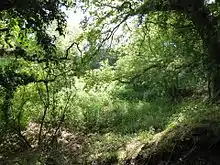
Neutral Farm Pit, Butley is a 1.1-hectare (2.7-acre) geological Site of Special Scientific Interest in Butley, east of Woodbridge in Suffolk.[1][2] It is a Geological Conservation Review site,[3] and is in the Suffolk Coast and Heaths Area of Outstanding Natural Beauty.[4]
This is described by Natural England as a classic site in the study of the Early Pleistocene in East Anglia. It was used by the nineteenth-century geologist Frederick W. Harmer to define his Butley division of the Red Crag Formation, and it has many fossils of marine molluscs.[5]
There is access to the site from Mill Lane.
References
- 1 2 3 4 "Designated Sites View: Neutral Farm Pit, Butley". Sites of Special Scientific Interest. Natural England. Retrieved 22 May 2017.
- ↑ "Map of Neutral Farm Pit, Butley". Sites of Special Scientific Interest. Natural England. Retrieved 22 May 2017.
- ↑ "Butley Neutral Farm Pit (Quaternary of East Anglia)". Geological Conservation Review. Joint Nature Conservation Committee. Retrieved 3 May 2017.
- ↑ "Suffolk Coast & Heaths Area of Outstanding Natural Beauty Management Plan 2013–2018" (PDF). Suffolk Coast & Heaths AONB. p. 76. Retrieved 6 August 2016.
- ↑ "Neutral Farm Pit, Butley citation" (PDF). Sites of Special Scientific Interest. Natural England. Retrieved 22 May 2017.
Wikimedia Commons has media related to Neutral Farm Pit, Butley.
This article is issued from Wikipedia. The text is licensed under Creative Commons - Attribution - Sharealike. Additional terms may apply for the media files.