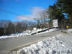
Route 123 | ||||
|---|---|---|---|---|
Map of southern New Hampshire with NH 123 highlighted in red | ||||
| Route information | ||||
| Maintained by NHDOT | ||||
| Length | 63.055 mi[1] (101.477 km) | |||
| Major junctions | ||||
| South end | Mason Road in Townsend, MA | |||
| North end | ||||
| Location | ||||
| Country | United States | |||
| State | New Hampshire | |||
| Counties | Hillsborough, Cheshire, Sullivan | |||
| Highway system | ||||
| ||||
| ||||


New Hampshire Route 123 (abbreviated NH 123) is a 63.055-mile-long (101.477 km) secondary north–south state highway in southwestern New Hampshire. The southern terminus of the route is at the Massachusetts state line in Mason where, as Mason Road, the road continues as an unnumbered local road in the town of Townsend. The northern terminus, as signed, is at the Connecticut River, where the highway continues west for 0.313 miles (0.504 km) to U.S. Route 5 in Westminster, Vermont, as Vermont Route 123 (VT 123). Route logs, however, place the terminus at New Hampshire Route 12 in Walpole.
In Walpole, NH 123 runs in a wrong-way concurrency with NH 12 north–south alongside the Connecticut River, the water body that represents the border between New Hampshire and Vermont. For the entire length of the NH 12/NH 123 concurrency, NH 123 South is, in reality, heading north on the compass while NH 123 North is traveling to the south.
History
In October 2005, heavy flooding in the New Hampshire area forced the closure of NH 123 in two different locations. The first was at the intersection of NH 123 and Cold River Road near Drewsville, where a bridge was destroyed from high water in the Cold River, approximately 5 miles (8 km) east of North Walpole. The second closure was approximately 3 miles (5 km) south of the junction with New Hampshire Route 123A in the town of Alstead, where a section of roadway was completely washed away by the water. Both sections were subsequently rebuilt and reopened.
Major intersections
| County | Location[1][2] | mi[1][2] [3] | km | Destinations | Notes | |||
|---|---|---|---|---|---|---|---|---|
| Hillsborough | Mason | 0.000 | 0.000 | Mason Road – Townsend | Massachusetts–New Hampshire line To | |||
| Greenville | 5.171 | 8.322 | Southern end of concurrency with NH 31 | |||||
| 5.439 | 8.753 | Northern end of NH 31/123 concurrency | ||||||
| 6.321 | 10.173 | Southern terminus of NH 45 | ||||||
| New Ipswich | 7.922 | 12.749 | Southern end of concurrency with NH 124 | |||||
| 9.440 | 15.192 | Northern terminus of NH 123A (southern segment) | ||||||
| 12.829 | 20.646 | Northern end of concurrency with NH 124 | ||||||
| Peterborough | 18.971 | 30.531 | Southern end of concurrency with NH 101 | |||||
| 19.835 | 31.921 | Northern end of concurrency with NH 101; southern end of concurrency with US 202 | ||||||
| 22.130 | 35.615 | Western terminus of NH 136 | ||||||
| Hancock | 25.553 | 41.124 | Northern end of concurrency with US 202 | |||||
| 28.099 | 45.221 | Southern end of wrong-way concurrency with NH 137 | ||||||
| 28.274 | 45.503 | Northern end of wrong-way concurrency with NH 137 | ||||||
| Cheshire | Stoddard | 35.287 | 56.789 | Southern end of concurrency with NH 9 | ||||
| 36.407 | 58.591 | Northern end of concurrency with NH 9 | ||||||
| Marlow | 44.259 | 71.228 | Southern end of concurrency with NH 10 | |||||
| 45.273 | 72.860 | Northern end of concurrency with NH 10 | ||||||
| Alstead | 53.979 | 86.871 | Southern end of concurrency with NH 12A | |||||
| 54.777 | 88.155 | Western terminus of NH 123A (northern segment) | ||||||
| 55.438 | 89.219 | Northern end of concurrency with NH 12A | ||||||
| Sullivan |
No major junctions | |||||||
| Cheshire | Walpole | 60.218 | 96.911 | Southern end of wrong-way concurrency NH 12 | ||||
| 62.943 | 101.297 | Northern end of wrong-way concurrency with NH 12 | ||||||
| Connecticut River | 63.055 0.000 | 101.477 0.000 | New Hampshire–Vermont state line | |||||
| Windham | Westminster | 0.313 | 0.504 | Western terminus of VT 123 | ||||
1.000 mi = 1.609 km; 1.000 km = 0.621 mi
| ||||||||
New Hampshire Route 123A

New Hampshire Route 123A (abbreviated NH 123A) is a designation held by two separate state highways in New Hampshire, United States. Although the two segments are not directly connected, they are linked by their parent route, New Hampshire Route 123.
Southern segment
New Hampshire Route 123A | |
|---|---|
| Location | New Ipswich |
| Length | 4.216 mi[1] (6.785 km) |
The southern segment of NH 123A is a 4.216-mile-long (6.785 km) secondary rural road that runs from the town of New Ipswich to the Massachusetts border.
The southern terminus of this segment is at the Massachusetts state line in New Ipswich. At this location, the road is locally named Ashburnham Road. The road continues into Massachusetts and becomes West Road in the town of Ashby. The northern terminus is at NH 123 and New Hampshire Route 124 in New Ipswich. At this location, NH 123A is locally named Main Street.
Northern segment
New Hampshire Route 123A | |
|---|---|
| Location | Alstead–Marlow |
| Length | 10.070 mi[1] (16.206 km) |
The northern segment of NH 123A is a 10.070-mile-long (16.206 km) secondary rural east–west highway in western New Hampshire, running between the towns of Alstead and Marlow. The eastern terminus of this segment of NH 123A is at New Hampshire Route 10 in Marlow. The western terminus is at NH 123 in Alstead. The road is the only numbered state highway in the town of Acworth, and is the main road through the village of South Acworth.
References
- 1 2 3 4 5 Bureau of Planning & Community Assistance (February 20, 2015). "NH Public Roads". Concord, New Hampshire: New Hampshire Department of Transportation. Retrieved April 7, 2015.
- 1 2 Bureau of Planning & Community Assistance (April 3, 2015). "Nodal Reference 2015, State of New Hampshire". New Hampshire Department of Transportation. Retrieved April 7, 2015.
- Town of Mason, Hillsborough County
- Town of Greenville, Hillsborough County
- Town of New Ipswich, Hillsborough County
- Town of Peterborough, Hillsborough County
- Town of Hancock, Hillsborough County
- Town of Stoddard, Cheshire County
- Town of Marlow, Cheshire County
- Town of Alstead, Cheshire County
- Town of Walpole, Cheshire County
- ↑ Mapping Section (November 15, 2016). "VTrans Route Logs and Progress Charts". VT 123. Policy, Planning, and Intermodal Development Division, Vermont Agency of Transportation. Retrieved February 18, 2017.