| New Hope River Tributary to Haw River | |
|---|---|
.jpg.webp) The New Hope River flooded into Jordan Lake, near where it combines with the Haw River. | |
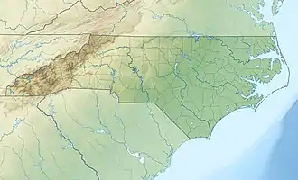
 Location of New Hope River mouth  New Hope River (Haw River tributary) (the United States) | |
| Location | |
| Country | United States |
| State | North Carolina |
| County | Chatham |
| Physical characteristics | |
| Source | confluence of New Hope Creek and Morgan Creek |
| • location | B. Everett Jordan Lake |
| • coordinates | 35°48′37″N 078°59′48″W / 35.81028°N 78.99667°W[1] |
| • elevation | 216 ft (66 m)[2] |
| Mouth | Haw River |
• location | B. Everett Jordan Lake |
• coordinates | 35°39′28″N 079°04′14″W / 35.65778°N 79.07056°W[1] |
• elevation | 216 ft (66 m)[2] |
| Length | 12.19 mi (19.62 km)[3] |
| Basin size | 342.98 square miles (888.3 km2)[4] |
| Discharge | |
| • location | Haw River |
| • average | 377.12 cu ft/s (10.679 m3/s) at mouth with Haw River[4] |
| Basin features | |
| Progression | Haw River → Cape Fear River → Atlantic Ocean |
| River system | Haw River |
| Tributaries | |
| • left | New Hope Creek Folkner Branch White Oak Creek Beaver Creek |
| • right | Morgan Creek Bush Creek Parkers Creek |
| Bridges | Farrington Road, US 64 |
New Hope River is a 12.19-mile-long (19.62 km) fifth-order tributary to the Haw River in Chatham County, North Carolina. This river is now entirely flooded as part of B. Everett Jordan Lake. All of the tributaries to the river are present as arms of the lake. New Hope River contributes 21.8% of the total water discharge for the Haw River.
Variant names
According to the Geographic Names Information System, it has also been known historically as:[1]
- New Hope Creek
- New River
- New-hope Creek
- Newhope Creek
Course
New Hope River is formed at the confluence of New Hope Creek and Morgan Creek in the northern part of B. Everett Jordan Lake. When it was a river it flowed south-southwest to the Haw River.[2]
Watershed
New Hope River drains 342.98 square miles (888.3 km2) of area, receives about 47.2 in/year of precipitation, and has a topographic wetness index of 451.04 and is about 49% forested.[4]
See also
References
- 1 2 3 "GNIS Detail - New Hope River". geonames.usgs.gov. US Geological Survey. Retrieved 9 October 2019.
- 1 2 3 "New Hope River Topo Map, Chatham County NC (Merry Oaks Area)". TopoZone. Locality, LLC. Retrieved 9 October 2019.
- ↑ "ArcGIS Web Application". epa.maps.arcgis.com. US EPA. Retrieved 9 October 2019.
- 1 2 3 "New Hope River Watershed Report". Waters Geoviewer. US EPA. Retrieved 9 October 2019.