State Road 113 | ||||
|---|---|---|---|---|
| Route information | ||||
| Maintained by NMDOT | ||||
| Length | 20.602 mi[1] (33.156 km) | |||
| Major junctions | ||||
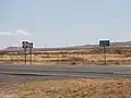
| South end | ||||
| North end | ||||
| Location | ||||
| Country | United States | |||
| State | New Mexico | |||
| Counties | Hidalgo | |||
| Highway system | ||||
| ||||
| ||||

State Road 113 (NM 113) is a state highway in the US state of New Mexico. Its total length is approximately 20.6 miles (33.2 km). NM 113's southern terminus is at NM 9 east of Windmill, and its northern terminus is at Interstate 10 (I-10) northwest of Separ.
Major intersections
The entire route is in Hidalgo County.
| Location | mi[2] | km | Destinations | Notes | |
|---|---|---|---|---|---|
| | 0.000 | 0.000 | Southern terminus | ||
| | 20.602 | 33.156 | Northern terminus, exit 34 (I-10) | ||
| 1.000 mi = 1.609 km; 1.000 km = 0.621 mi | |||||
See also
References
- ↑ "Posted Route: Legal Description" (PDF). New Mexico Department of Transportation. March 16, 2010. p. 91. Retrieved October 10, 2018.
- ↑ "TIMS Road Segments by Posted Route/Point with AADT Info; NM, NMX-Routes" (PDF). New Mexico Department of Transportation. April 3, 2013. pp. 5–7. Retrieved October 10, 2018.
External links
Wikimedia Commons has media related to New Mexico State Road 113.
 Geographic data related to New Mexico State Road 113 at OpenStreetMap
Template:Attached KML/New Mexico State Road 113
KML is not from Wikidata
This article is issued from Wikipedia. The text is licensed under Creative Commons - Attribution - Sharealike. Additional terms may apply for the media files.