
Districts and tapere on Rarotonga.
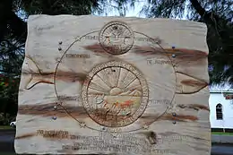
Commemorative marker at Ngataniia Bay
Ngatangiia is one of the five districts that make up the island of Rarotonga in the Cook Islands.[1] It is located in the east of the island, to the south of the districts of Matavera and Avarua, and northeast of the district of Titikaveka.

Circle of stones commemorates the Cook Islanders who colonized New Zealand
References
- ↑ "Official Map of Rarotonga". Cook Islands Ministry of Justice. Retrieved 10 August 2020.
21°15′0.91″S 159°44′16.19″W / 21.2502528°S 159.7378306°W
This article is issued from Wikipedia. The text is licensed under Creative Commons - Attribution - Sharealike. Additional terms may apply for the media files.