North Carolina Highway 261 | ||||
|---|---|---|---|---|
 | ||||
| Route information | ||||
| Maintained by NCDOT | ||||
| Length | 12.8 mi[1] (20.6 km) | |||
| Existed | 1952–present | |||
| Major junctions | ||||
| South end | ||||
| North end | ||||
| Location | ||||
| Country | United States | |||
| State | North Carolina | |||
| Counties | Mitchell | |||
| Highway system | ||||
| ||||
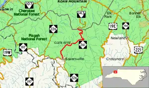
North Carolina Highway 261 (NC 261) is a short state highway going from Bakersville to the Tennessee state line where the road turns into Tennessee State Route 143 (SR 143). The road is only 12.8 miles (20.6 km) long and is very curvy. The road is close to Roan Mountain State Park in Tennessee.
Route description
NC 261 begins in the town of Bakersville, the county seat of Mitchell County, at a stop-controlled T-intersection with NC 226 (Crimson Laurel Way). It immediately climbs a short hill out of the town and into the Pisgah National Forest. As it starts to head in a northeastern general direction, NC 261 begins a winding course between the Cub Creek and Pumpkin Patch Mountain. After crossing Pumpkin Patch Gap (elevation approximately 3,140 feet (960 m)), the road begins to follow the Little Rock Creek and pass through the communities of Cookstown and Glen Ayre. three miles (4.8 km) outside of Glen Ayre, after paralleling more streams, NC 261 starts a climb up to Roan Mountain. Afters some hairpin turns, the road reaches Carvers Gap (elevation 5,500 feet (1,680 m)) where the state line and Appalachian Trail crosses the road. Tennessee SR 143 continues ahead towards the community of Roan Mountain.[1][2][3]
History
What became NC 261 was an unnumbered gravel and dirt road between Bakersville and Carvers Gap. Between 1949 and 1953, the state took over the road and paved it with asphalt.[4][5] The routing has not changed since its original designation.
Junction list
The entire route is in Mitchell County.
| Location | mi[1] | km | Destinations | Notes | |
|---|---|---|---|---|---|
| Bakersville | 0.0 | 0.0 | |||
| | 12.8 | 20.6 | Tennessee state line | ||
| 1.000 mi = 1.609 km; 1.000 km = 0.621 mi | |||||
References
- 1 2 3 Google (June 20, 2014). "North Carolina Highway 261" (Map). Google Maps. Google. Retrieved June 20, 2014.
- ↑ Bakersville, NC/TN Quadrangle (Map). 1 : 24,000. 7.5 Minute Series (Topographic). United States Geological Survey. 1997. Retrieved March 6, 2016.
- ↑ Carvers Gap, NC/TN Quadrangle (Map). 1 : 24,000. 7.5 Minute Series (Topographic). United States Geological Survey. 1994. Retrieved March 6, 2016.
- ↑ Mitchell County - Tenth Division (PDF) (Map). North Carolina State Highway and Public Works Commission. June 30, 1949. p. 94. Retrieved March 6, 2016.
- ↑ Mitchell County - Thirteenth Division (PDF) (Map). North Carolina State Highway and Public Works Commission. January 1, 1953. p. 96. Retrieved March 6, 2016.
