North Texas | |
|---|---|
 North Texas counties in red | |
| Country | |
| State | |
| Largest city | |
| Population (2020) | |
| • Total | 8,584,519[1][2][3][4][5][6] |
North Texas (also commonly called North Central Texas) is a term used primarily by residents of Dallas, Fort Worth, and surrounding areas to describe much of the north-central portion of the U.S. state of Texas.[7][8][9][10] Residents of the Dallas–Fort Worth metroplex generally consider North Texas to include the area south of Oklahoma, east of Abilene, west of Paris, and north of Waco.[11] A more precise term for this region would be the northern part of the central portion of Texas. It does not include the Panhandle of Texas, which expands further north than the region previously described, nor does it include most of the region near the northern border of Texas.
Today, North Texas is centered upon the Dallas–Fort Worth metroplex, the largest metropolitan area in Texas and the Southern United States. People in the Dallas and Fort Worth areas sometimes use the terms Metroplex, DFW, and North Texas interchangeably. However, North Texas refers to a much larger area that includes many rural counties along the northern border.[12]
History
Indigenous tribes in North Texas included the Caddo, Tawakoni, Wichita, Kickapoo, and Comanche.[13][14][15] With European colonization, Mexican independence, and Texan independence and annexation to the United States, many of these tribes experienced demographic decline through relocation, slavery, etc. Since European colonization and the independence movements, the North Texas area was settled and most notably developed the cities of Dallas and Fort Worth.
Climate
The North Texas climate is subtropical with hot summers. It is also continental, characterized by a wide annual temperature range. Average annual precipitation also varies considerably, ranging from less than 28 to more than 48 inches (700–1200 mm). Severe storms are frequent in the spring, as the area lies in the southern section of "tornado alley".
South is the prevailing wind direction, and southerly winds are frequently high and persist for several days. Strong northerly winds often occur during the passage of cold fronts. Dusty conditions are infrequent, occurring mostly with westerly winds. Dust storm frequency and intensity depend on soil conditions in eastern New Mexico, West Texas, and the Texas Panhandle.
Winters can be mild, but northers occur about three times each month, and often are accompanied by sudden drops in temperature. In Dallas, a record-setting 12.8 inches of snow fell in February 2010. Periods of extreme cold that occasionally occur are short-lived, so that even in January mild weather occurs frequently.[16]
The highest temperatures of summer are associated with fair skies, westerly winds, and moderate to high humidities. Characteristically, hot spells in summer are broken into three- to five-day periods by thunderstorm activity. There are only a few nights each summer when the low temperature exceeds 80 °F (27 °C). Summer daytime temperatures frequently exceed 100 °F (38 °C). Air conditioners are recommended for maximum comfort indoors and while traveling via automobile.
Throughout the year, rainfall occurs more frequently during the night. Usually, periods of rainy weather last for only a day or two, and are followed by several days with fair skies. A large part of the annual precipitation results from thunderstorm activity, with occasional heavy rainfall over brief periods of time. Thunderstorms occur throughout the year, but are most frequent in the spring. Hail falls on about two or three days a year, ordinarily with only slight and scattered damage. Windstorms occurring during thunderstorm activity are sometimes destructive. Snowfall is uncommon.
The average length of the warm season (freeze-free period) is about 249 days. The average last occurrence of 32 °F (0 °C) or below is mid March and the average first occurrence of 32 °F or below is in late November.[17]
Counties
Although the terms "Northeastern Texas" or "North Texas" are not official state designations, the Texas State Data Center and Office of the State Demographer lists the following counties as belonging to the North Central Texas Council of Governments (NCTCOG):[18][19]
|
|
The Texas State Demographer also lists the following regional county groupings, some or all of which are often included in the informal meaning of the terms "North Texas" or "North Central Texas."
Additionally, some other Texas counties contiguous with those named above are sometimes included in the general meaning of "North Texas."
Major cities
| City | Population (2023) | State rank | U.S. rank |
|---|---|---|---|
 Dallas |
1,259,404 | 3 | 9 |
 Fort Worth |
961,885 | 5 | 13 |
 Arlington |
390,399 | 7 | 50 |
 Plano |
291,450 | 9 | 69 |
 Garland |
235,293 | 12 | 91 |
 Irving |
248,931 | 13 | 93 |
 Grand Prairie |
199,395 | 15 | 127 |
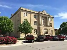 McKinney |
214,302 | 17 | 155 |
 Frisco |
227,528 | 18 | 162 |
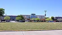 Mesquite |
143,792 | 20 | 181 |
 Carrollton |
132,935 | 23 | 197 |
 Denton |
160,564 | 26 | 202 |
 Richardson |
113,613 | 32 | 255 |
 Wichita Falls |
103,687 | 35 | 285 |
 Lewisville |
114,170 | 36 | 288 |
 Allen |
109,411 | 40 | |
 Flower Mound |
79,102 | 50 | |
Other cities and towns
Statistical areas
In the North Texas region there is one combined statistical area, three metropolitan areas, and seven micropolitan areas.
Dallas–Fort Worth TX-OK combined statistical area
Metropolitan statistical areas (MSAs)

- Dallas–Fort Worth–Arlington is the only MSA in Texas subdivided into metropolitan divisions:
- Dallas–Plano–Irving (Collin, Dallas, Denton, Ellis, Hunt, Kaufman, and Rockwall counties)
- Fort Worth–Arlington–Grapevine (Johnson, Parker, Tarrant, and Wise counties)
- Sherman–Denison (Grayson County)
Micropolitan statistical areas (μSAs)
- Athens (Henderson County) (In East Texas)
- Bonham (Fannin County)
- Corsicana (Navarro County)
- Durant, OK (Bryan County, Oklahoma) (In Oklahoma)
- Gainesville (Cooke County)
- Granbury (Hood County)
- Mineral Wells (Palo Pinto County)
Wichita Falls area
Metropolitan statistical areas (MSAs)
- Wichita Falls (Archer, Clay, Wichita counties)
Micropolitan statistical areas (μSAs)
- Vernon (Wilbarger County)
Other
Micropolitan statistical Areas (μSAs)
- Stephenville (Erath County)
Economy
Top employers
Dallas–Fort Worth metroplex[22]
| Company | No. of employees locally |
Type of business |
|---|---|---|
| Wal-Mart Stores, Inc. | 34,000 | Retail |
| American Airlines | 27,000 | Commercial airline |
| Texas Health Resources | 22,296 | Health care |
| Dallas Independent School District | 19,740 | Education |
| Baylor Health Care System | 16,500 | Health care |
Wichita Falls metropolitan area[23]
| # | Employer | # of Employees |
|---|---|---|
| 1 | Sheppard Air Force Base | 12,272 |
| 2 | Wichita Falls Independent School District | 2,059 |
| 3 | North Texas State Hospital | 1,974 |
| 4 | United Regional Health Care System | 1,778 |
| 5 | City of Wichita Falls | 1,477 |
| 6 | Midwestern State University | 1,284 |
| 7 | James V. Allred Unit | 971 |
| 8 | Cryovac | 732 |
| 9 | Work Services Corporation | 730 |
| 10 | Howmet Castings | 704 |
Sherman–Denison metropolitan area[24]
| # | Employer | # of Employees |
|---|---|---|
| 1 | Tyson Foods | 1,400 |
| 2 | Texoma Health Systems | 1,375 |
| 3 | Texas Instruments | 1,200 |
| 4 | Cigna | 1,000 |
| 5 | Wilson N Jones Health Systems | 1,000 |
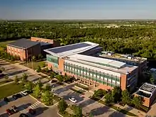
Colleges and universities
| School | Enrollment | Location | Mascot | Athletic affiliation (conference) |
|---|---|---|---|---|
 Southern Methodist University |
11,643 | University Park | Mustangs | NCAA Division I FBS (American) |
 Texas Christian University |
10,323 | Fort Worth | Horned Frogs | NCAA Division I FBS (Big 12) |
 Dallas Baptist University |
5,445 | Dallas | Patriots | NCAA Division II (Lone Star) Non–Football, compete in the Missouri Valley Conference at the Division I level for baseball |
.jpg.webp) Texas Wesleyan University |
3,378 | Fort Worth | Rams | NAIA (Sooner) |
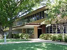 University of Dallas |
2,576 | Irving | Crusaders | NCAA Division III (SCAC) Non–Football, compete in Texas Rugby Union at the Division II level for Rugby |
 Southwestern Assemblies of God University |
2,012 | Waxahachie | Lions | NAIA NCCAA (Sooner) |
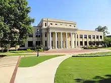 Austin College |
1,224 | Sherman | Roos | NCAA Division III (SCAC) Compete in the Southern Athletic Association for football |
 Paul Quinn College |
600 | Dallas | Tigers | NAIA (Red River) Non–Football |
Sports
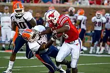
The North Texas region has teams from the four major professional sports leagues. Major professional sports first came to the area in 1960, when the Dallas Cowboys began competing in the National Football League and the Dallas Texans began competing in the American Football League. (The Texans later relocated to Kansas City and became the Chiefs). In 1972, Major League Baseball's Washington Senators moved to Arlington to become the Texas Rangers, named after the statewide law enforcement agency. The National Basketball Association expanded into North Texas in 1980 when the Dallas Mavericks were added to the league. The fourth sport was added in 1993 when the Minnesota North Stars of the National Hockey League moved to Dallas, becoming the Dallas Stars.
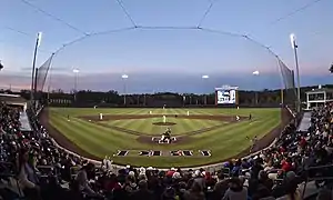
The Major League Soccer team FC Dallas is based in Frisco, and the Dallas Wings of the WNBA plays in Arlington. The area is also home to many minor league professional teams and four colleges that compete in NCAA Division I athletics.
Major professional sports teams
| Club | Sport | Founded | League | Venue |
|---|---|---|---|---|
 Dallas Cowboys |
Football | 1960 | NFL | AT&T Stadium |
 Texas Rangers |
Baseball | 1972^ | MLB | Globe Life Field |
 Dallas Mavericks |
Basketball | 1980 | NBA | American Airlines Center |
 Dallas Stars |
Hockey | 1993^ | NHL | American Airlines Center |
 FC Dallas |
Soccer | 1996 | MLS | Toyota Stadium |
 Dallas Wings |
Basketball | 2015^ | WNBA | College Park Center |
^- Indicates year team relocated to the area
Other professional teams
^- Indicates year team relocated to the area
Division I college teams
The headquarters for both the Big 12 and Conference USA are located in Irving, and the Southland Conference headquarters are in Frisco.
Transportation
Commercial airports

Public transit

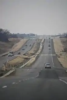
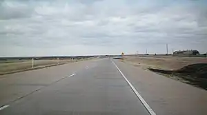
Major highways
Interstates

.jpg.webp)
U.S. Routes

Tollways

See also
References
- ↑ "U.S. Census Bureau QuickFacts: Hood County, Texas; Erath County, Texas; Denton County, Texas; Ellis County, Texas; Collin County, Texas; Dallas County, Texas". Census.gov. Retrieved 2022-07-20.
- ↑ "U.S. Census Bureau QuickFacts: Parker County, Texas; Palo Pinto County, Texas; Navarro County, Texas; Kaufman County, Texas; Johnson County, Texas; Hunt County, Texas". Census.gov. Retrieved 2022-07-20.
- ↑ "U.S. Census Bureau QuickFacts: Baylor County, Texas; Archer County, Texas; Wise County, Texas; Tarrant County, Texas; Somervell County, Texas; Rockwall County, Texas". Census.gov. Retrieved 2022-07-20.
- ↑ "U.S. Census Bureau QuickFacts: Montague County, Texas; Jack County, Texas; Hardeman County, Texas; Foard County, Texas; Cottle County, Texas; Clay County, Texas". Census.gov. Retrieved 2022-07-20.
- ↑ "U.S. Census Bureau QuickFacts:Grayson County, Texas; Fannin County, Texas; Cooke County, Texas; Young County, Texas; Wilbarger County, Texas; Wichita County, Texas". Census.gov. Retrieved 2022-07-20.
- ↑ "U.S. Census Bureau QuickFacts: Taylor County, Texas; Jones County, Texas; Haskell County, Texas; Knox County, Texas; Hamilton County, Texas". Census.gov. Retrieved 2022-07-20.
- ↑ "North Texas Facts and Figures from the North Texas Commission". NTC-DFW. Retrieved 2022-06-02.
It is a 9,000-square-mile, 13-county region that is home to 7.5 million people. North Texas is made up of 150 cities – including Dallas and Fort Worth – with 15 of those cities boasting a population of more than 100,000.
- ↑ "Counties in the North Central Texas Region of Texas - US Travel Notes". travelnotes.org. Retrieved 2022-06-02.
- ↑ "Why Grayson County? | North Texas Regional Airport". Retrieved 2022-06-02.
- ↑ "TSHA | Grayson County". www.tshaonline.org. Retrieved 2022-06-02.
Grayson County, in north central Texas, is bordered by the Red River and by Fannin, Collin, Denton, and Cooke counties. The county seat, Sherman, which lies approximately sixty-five miles north of Dallas, is part of the Sherman-Denison Metropolitan Statistical Area.
- ↑ "North Central Texas Council of Governments". Texas Association of Regional Councils. Retrieved 2022-06-02.
- ↑ "W5JCK Map of North-Central Texas Counties". Retrieved 26 March 2023.
- ↑ "Indians".
- ↑ "What happened to Native American tribes that once existed in North Texas? Curious Texas investigates". Dallas News. 25 December 2020. Retrieved 26 March 2023.
- ↑ Murray, Brandon (24 November 2021). "Tales from the Dallas History Archives: Honoring Native American Heritage Month". Retrieved 26 March 2023.
- ↑ "Snow: Dallas/Fort Worth's Top-20 Largest Snowfalls on Record". Retrieved 26 March 2023.
- ↑ "DFW Climate Narrative".
- 1 2 3 "Counties by Regional Councils of Governments". Retrieved 26 March 2023.
- ↑ "www.NCTCOG.org". Retrieved 26 March 2023.
- ↑ "Counties". Archived from the original on 2008-11-20. Retrieved 2008-05-20.
- ↑ Texoma Council of Governments
- ↑ Dallas Business Journal 2016
- ↑ "City of Wichita CAFR" (PDF). Retrieved 26 March 2023.
- ↑ "Sherman-Denison Employers". Archived from the original on 2015-06-11. Retrieved 2016-06-02.

.jpg.webp)



.jpg.webp)
.jpg.webp)
_football_game%252C_Navy_Midshipmen_running_back%252C_Shun_White%252C_attempts_a_to_run_against_UNT's_defense.jpg.webp)

.jpg.webp)
.svg.png.webp)
.svg.png.webp)
.svg.png.webp)
.svg.png.webp)
.svg.png.webp)


