North Musi Rawas Regency
(Kabupaten Musi Rawas Utara) Muratara | |
|---|---|
 Coat of arms | |
| Nickname: Muratara | |
| Motto(s): Malay: Berselang Serundingan Indonesian: Kebersamaan Kesepakatan English: Togetherness in the one Consensus | |
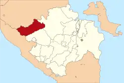 Location of North Musi Rawas Regency in red | |
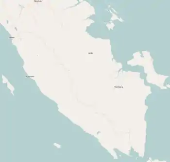
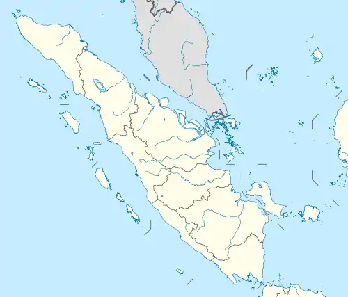
| Coordinates: 2°29′07″S 103°17′37″E / 2.4853°S 103.2935°E | |
| Country | Indonesia |
| Province | South Sumatra |
| Established | 2013 |
| Founded by | Government of Indonesia |
| Regency seat | Rupit |
| Government | |
| • Type | Regency Government |
| • Regent | Syarif Hidayat |
| • Vice Regent | Devi Suhartoni |
| Area | |
| • Total | 6,008.66 km2 (2,319.96 sq mi) |
| Population (mid 2022 estimate)[1] | |
| • Total | 192,369 |
| • Density | 32/km2 (83/sq mi) |
| • Ethnicity | Malay and Others |
| Time zone | UTC+7 (Indonesia Western Standard Time) |
| Postcode | 316xx |
| Area code | (+62) 733 |
| Website | muratarakab.go.id/ |

North Musi Rawas Regency (Indonesian: Kabupaten Musi Rawas Utara abbreviation Muratara) is a regency of South Sumatra Province, Indonesia. It takes its name from the two main river which drain that area, Musi River and Rawas River. This regency was created on 10 June 2013 by splitting off the seven northernmost districts of Musi Rawas Regency.
The new regency borders Jambi province to the north, Musi Banyuasin Regency to the east, Musi Rawas Regency to the south, and Bengkulu province to the west.[2] It covers an area of 6,008.66 km2 and had a population of 169,432 at the 2010 Census[3] and 188,861 at the 2020 Census;[4] the official estimate as at mid 2022 was 192,369.[1] The administrative centre is the town of Rupit.
Administrative districts
The new Regency comprises seven of the districts (kecamatan) which were previously part of Musi Rawas Regency. These seven districts are listed below with their areas and their populations at the 2010 Census[3] and 2020 Census,[4] together with the official estimates as at mid 2022.[1] The table also includes the locations of the district administrative centres, the number of administrative villages in each district (a total of 82 rural desa and 7 urban kelurahan), and its post code.
| Kode Wilayah | Name of District (kecamatan) | Area in km2 | Pop'n Census 2010 | Pop'n Census 2020 | Pop'n Estimate mid 2022 | Admin centre | No. of villages | Post code |
|---|---|---|---|---|---|---|---|---|
| 16.13.07 | Ulu Rawas | 1,452.88 | 10,772 | 12,034 | 12,258 | Muara Kulam | 7 | 31669 |
| 16.13.06 | Karang Jaya | 1,408.03 | 27,855 | 30,191 | 30,574 | Karang Jaya | 15 | 31654 |
| 16.13.02 | Rawas Ulu | 498.17 | 31,037 | 33,945 | 34,436 | Pasar Surulangun | 17 | 31656 |
| 16.13.01 | Rupit | 409.76 | 31,602 | 37,862 | 39,084 | Muara Rupit | 17 | 31653 |
| 16.13.05 | Karang Dapo | 548.76 | 17,720 | 20,302 | 20,782 | Karang Dapo I | 9 | 31658 |
| 16.13.04 | Rawas Ilir | 1,088.13 | 28,178 | 28,454 | 28,423 | Bingin Teluk | 13 | 31655 |
| 16.13.03 | Nibung | 602.93 | 22,268 | 26,073 | 26,802 | Karya Makmur | 11 | 31667 |
| Total Regency | 6,008.66 | 169,432 | 188,861 | 192,369 | Rupit | 89 |
Note the 7 kelurahan are the seven administrative centres of the districts as shown above.
References
External links
Regencies and cities of South Sumatra | ||
|---|---|---|
Capital: Palembang | ||
| Regencies | ||
| Cities | ||