| North River | |
|---|---|
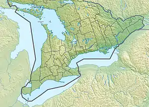 Location of the mouth of the North River in southern Ontario | |
| Location | |
| Country | Canada |
| Province | Ontario |
| Region | Central Ontario |
| County | Peterborough |
| Municipality | Havelock-Belmont-Methuen |
| Physical characteristics | |
| Source | Imp lake |
| • coordinates | 44°45′24″N 77°54′42″W / 44.75667°N 77.91167°W |
| • elevation | 302 m (991 ft) |
| Mouth | Belmont Lake, on the Crowe River |
• coordinates | 44°30′17″N 77°50′03″W / 44.50472°N 77.83417°W |
• elevation | 187 m (614 ft) |
| Basin features | |
| River system | Great Lakes Basin |
The North River is a river in the municipality of Havelock-Belmont-Methuen, Peterborough County in Central Ontario, Canada.[1] It is part of the Great Lakes Basin, and is a right tributary of the Crowe River.
The river begins at Imp Lake in geographic Methuen Township[2] and flows south, past the Blue Mountain Mine at Devil's Lake, to Kasshabog Lake. It continues south to Long Lake, then turns east, then resumes a southward direction, and enters geographic Belmont Township.[3] The river passes through Round Lake, turns east, and reaches its mouth at Belmont Lake on the Crowe River, which flows via the Trent River to Lake Ontario.
Tributaries
- Otter Creek (left)
- Whitney Creek (left)
- Beloporine Creek (right)
See also
References
- ↑ "North River". Geographical Names Data Base. Natural Resources Canada. Retrieved 2015-02-07.
- ↑ "Methuen" (PDF). Geology Ontario - Historic Claim Maps. Ontario Ministry of Northern Development, Mines and Forestry. Retrieved 2015-02-07.
- ↑ "Belmont" (PDF). Geology Ontario - Historic Claim Maps. Ontario Ministry of Northern Development, Mines and Forestry. Archived from the original (PDF) on 2015-02-08. Retrieved 2015-02-07.
Sources
- Map 6 (PDF) (Map). 1 : 700,000. Official road map of Ontario. Ministry of Transportation of Ontario. 2014. Retrieved 2015-02-07.
- Restructured municipalities - Ontario map #5 (Map). Restructuring Maps of Ontario. Ontario Ministry of Municipal Affairs and Housing. 2006. Retrieved 2015-02-07.
This article is issued from Wikipedia. The text is licensed under Creative Commons - Attribution - Sharealike. Additional terms may apply for the media files.