| North Talwood Queensland | |||||||||||||||
|---|---|---|---|---|---|---|---|---|---|---|---|---|---|---|---|
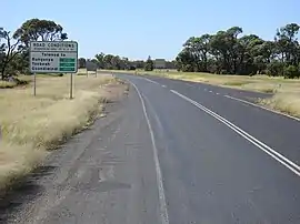
 Road conditions sign, Talwood | |||||||||||||||
 North Talwood | |||||||||||||||
| Coordinates | 28°24′45″S 149°23′22″E / 28.4125°S 149.3894°E | ||||||||||||||
| Population | 169 (2016 census)[1] | ||||||||||||||
| • Density | 0.1826/km2 (0.4730/sq mi) | ||||||||||||||
| Postcode(s) | 4496 | ||||||||||||||
| Area | 925.4 km2 (357.3 sq mi) | ||||||||||||||
| Time zone | AEST (UTC+10:00) | ||||||||||||||
| LGA(s) | Goondiwindi Region | ||||||||||||||
| State electorate(s) | |||||||||||||||
| Federal division(s) | Maranoa | ||||||||||||||
| |||||||||||||||
North Talwood is a rural locality in the Goondiwindi Region, Queensland, Australia.[2] In the 2016 census, North Talwood had a population of 169 people.[1]
Geography
Talwood is a town (28°29′07″S 149°28′05″E / 28.4852°S 149.4680°E) at the southern edge of the locality immediately north of the boundary of South Talwood.[3]
North Talwood is mostly bounded to the south by the South-Western railway line, which enters the locality from the south-east (South Talwood / Bungunya) and exits to the south-west (South Talwood / Weengallon). The locality is served by Talwood railway station in the town (28°29′05″S 149°28′06″E / 28.4846°S 149.4683°E).[3][4]
The Barwon Highway enters the locality in the south-east (Bungunya), passes through the town, and exits to the west (Weengallon).[3]
History
The name Talwood comes from the town, which was named from the Dalwood run name, which in turn was named in 1844, probably a corruption of an Aboriginal language word. Historically it is sometimes written as Tallwood.[3]
In the 2016 census, North Talwood had a population of 169 people.[1]
Education
Talwood State School is a government primary (Prep-6) school for boys and girls at 17 Recreation Street (28°29′12″S 149°28′13″E / 28.4866°S 149.4703°E).[5][6] In 2018, the school had an enrolment of 28 students with 4 teachers (3 full-time equivalent) and 5 non-teaching staff (2 full-time equivalent).[7]
The nearest government secondary school is Goondiwindi State High School in Goondiwindi to the east.[8]
References
- 1 2 3 Australian Bureau of Statistics (27 June 2017). "North Talwood (SSC)". 2016 Census QuickStats. Retrieved 20 October 2018.
- ↑ "North Talwood – locality in Goondiwindi Region (entry 49286)". Queensland Place Names. Queensland Government. Retrieved 23 October 2020.
- 1 2 3 4 "Talwood – population centre in Goondiwindi Regional (entry 33213)". Queensland Place Names. Queensland Government. Retrieved 23 October 2020.
- ↑ "Railway stations and sidings - Queensland". Queensland Open Data. Queensland Government. 27 August 2020. Archived from the original on 5 October 2020. Retrieved 5 October 2020.
- ↑ "State and non-state school details". Queensland Government. 9 July 2018. Archived from the original on 21 November 2018. Retrieved 21 November 2018.
- ↑ "Talwood State School". Retrieved 21 November 2018.
- ↑ "ACARA School Profile 2018". Australian Curriculum, Assessment and Reporting Authority. Retrieved 28 January 2020.
- ↑ "Queensland Globe". State of Queensland. Retrieved 25 September 2021.