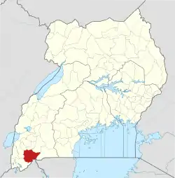
| Ntungamo–Mirama Hills Road | |
|---|---|
| Route information | |
| Length | 23 mi (37 km) |
| History | Designated in 2014 Completion in 2017.[1] |
| Major junctions | |
| North end | Ntungamo |
| South end | Mirama Hills |
| Location | |
| Country | Uganda |
| Highway system | |
The Ntungamo–Mirama Hills Road is a road in the Western Region of Uganda, connecting the towns of Ntungamo and Mirama Hills, both in Ntungamo District.[1]
Location
The road starts at Ntungamo and continues southeast, ending at Mirama Hills at the international border with Rwanda, a distance of approximately 35 kilometres (22 mi).[2] The coordinates of the road near Ruhaama are 0°59'07.0"S, 30°21'03.0"E (Latitude:-0.985278; Longitude:30.350833).[3]
Upgrading to bitumen
On 6 October 2014, President Yoweri Museveni officially commissioned the upgrading of this road to a bitumen surface. It is funded jointly by the government of Uganda (50 percent) and TradeMark East Africa, a subsidiary of the United Kingdom's Department for International Development (US$22 million). The road was expected to be ready for use in April 2016.[4][5] After delays related to land compensation, the expected completion date was moved to December 2016.[6] In September 2017, The EastAfrican, reported that the road had been completed.[1]
See also
References
- 1 2 3 Asiimwe, Dicta (27 September 2017). "New road opens access to border post". The EastAfrican. Nairobi. Retrieved 27 September 2017.
- ↑ GFC (14 July 2015). "Distance between Ntungamo, Western Region, Uganda and Mirama Hills, Western Region, Uganda". Globefeed.com (GFC). Retrieved 27 September 2017.
- ↑ Google (14 July 2015). "Location of Ntungamo–Mirama Hills Road Near Ruhaama" (Map). Google Maps. Google. Retrieved 14 July 2015.
- ↑ TMEA (7 October 2014). "Ntungamo-Mirama Hills Ground Breaking road ceremony expected to boost cross border trade between Uganda And Rwanda". TradeMark East Africa (TMEA). Retrieved 14 July 2015.
- ↑ Alfred Tumushabe, and Perez Rumanzi (8 October 2015). "Museveni commissions Ntungamo-Mirama Road". Daily Monitor. Kampala. Retrieved 14 July 2015.
- ↑ Kanyesigye, Mark (7 December 2015). "Ntungamo Residents Finally Permit Road Construction Progress". Kampala: Chimpreports.com. Retrieved 28 June 2016.
