Nymburk District
Okres Nymburk | |
|---|---|
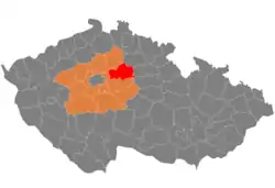
 Location in the Central Bohemian Region within the Czech Republic | |
| Coordinates: 50°13′N 15°6′E / 50.217°N 15.100°E | |
| Country | |
| Region | Central Bohemian |
| Capital | Nymburk |
| Area | |
| • Total | 846.40 km2 (326.80 sq mi) |
| Population (2023)[2] | |
| • Total | 105,463 |
| • Density | 120/km2 (320/sq mi) |
| Time zone | UTC+1 (CET) |
| • Summer (DST) | UTC+2 (CEST) |
| Municipalities | 86 |
| * Towns | 7 |
| * Market towns | 3 |
Nymburk District (Czech: okres Nymburk) is a district in the Central Bohemian Region of the Czech Republic. Its capital is the town of Nymburk.
Administrative division
Nymburk District is divided into three administrative districts of municipalities with extended competence: Nymburk, Lysá nad Labem and Poděbrady.
List of municipalities
Towns are marked in bold and market towns in italics:
Běrunice - Bobnice - Bříství - Budiměřice - Chleby - Choťánky - Chotěšice - Chrást - Chroustov - Čilec - Činěves - Dlouhopolsko - Dobšice - Dvory - Dymokury - Hořany - Hořátev - Hradčany - Hradištko - Hrubý Jeseník - Jíkev - Jiřice - Jizbice - Kamenné Zboží - Kněžice - Kněžičky - Kolaje - Kostelní Lhota - Kostomlátky - Kostomlaty nad Labem - Košík - Kounice - Kouty - Kovanice - Krchleby - Křečkov - Křinec - Libice nad Cidlinou - Loučeň - Lysá nad Labem - Mcely - Městec Králové - Milčice - Milovice - Netřebice - Nový Dvůr - Nymburk - Odřepsy - Okřínek - Opočnice - Opolany - Oseček - Oskořínek - Ostrá - Pátek - Písková Lhota - Písty - Poděbrady - Podmoky - Přerov nad Labem - Rožďalovice - Sadská - Sány - Seletice - Semice - Senice - Sloveč - Sokoleč - Stará Lysá - Starý Vestec - Straky - Stratov - Třebestovice - Úmyslovice - Velenice - Velenka - Vestec - Vlkov pod Oškobrhem - Vrbice - Vrbová Lhota - Všechlapy - Vykáň - Záhornice - Zbožíčko - Žitovlice - Zvěřínek
Geography

The surface of the district has a distinctly flat character, a significant part of the district lies in the Polabí lowland. The territory extends into three geomorphological mesoregions: Central Elbe Table (most of the territory), Jizera Table (small parts in the west and north) and East Elbe Table (very small part in the east). The highest point of the district is the hill Na kostele in Kněžice with an elevation of 299 m (981 ft), which is the lowest among all districts in the country. The lowest point is the river bed of the Elbe in Přerov nad Labem at 173 m (568 ft).
From the total district area of 846.4 km2 (326.8 sq mi), agricultural land occupies 584.8 km2 (225.8 sq mi), forests occupy 148.5 km2 (57.3 sq mi), and water area occupies 18.5 km2 (7.1 sq mi). Forests cover 17.5% of the district's area.[1]
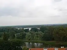
The most important river is the Elbe, flowing from the south to the west. The north of the district is drained by the Mrlina (a tributary of the Elbe). Several kilometres of the Cidlina also flow through the territory before its confluence with the Elbe. There are some middle-sized ponds, but none larger than 25 ha (62 acres). There are also several artificial lakes in the vicinity of the Elbe, created by flooding sand quarries.
There are no large-scale protected areas.
Demographics
|
|
| ||||||||||||||||||||||||||||||||||||||||||||||||||||||
| Source: Censuses[3][4][lower-alpha 1] | ||||||||||||||||||||||||||||||||||||||||||||||||||||||||
Most populated municipalities
| Name | Population[2] | Area (km2) |
|---|---|---|
| Nymburk | 15,424 | 21 |
| Poděbrady | 14,902 | 34 |
| Milovice | 13,634 | 28 |
| Lysá nad Labem | 10,047 | 34 |
| Sadská | 3,235 | 16 |
| Městec Králové | 2,873 | 20 |
| Kostomlaty nad Labem | 1,905 | 18 |
| Kounice | 1,661 | 11 |
| Rožďalovice | 1,628 | 24 |
| Semice | 1,486 | 9 |
Economy
The largest employers with headquarters in Nymburk District and at least 500 employees are:[5]
| Economic entity | Location | Number of employees | Main activity |
|---|---|---|---|
| Super Pet | Poděbrady | 1,000–1,499 | Retail sale |
| Louda Auto | Choťánky | 500–999 | Trade and maintenance of motor vehicles |
| Fresenius Kabi Horatev CZ | Hořátev | 500–999 | Manufacture of medical supplies |
| Nymburk Hospital | Nymburk | 500–999 | Health care |
| Crystal Bohemia | Poděbrady | 500–999 | Manufacture of glass and glass products |
Transport
The D11 motorway from Prague to Hradec Králové passes through the southern part of the district.
Sights

The most important monuments in the district, protected as national cultural monuments, are:[6]
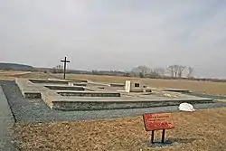
- Slavník gord in Libice nad Cidlinou
- Crematorium in Nymburk
- Hydroelectric power plant in Poděbrady
The best-preserved settlements and archaeological sites, protected as monument reservations and monument zones, are:[7]
- Bošín (monument reservation)
- Area of the Slavník gord in Libice nad Cidlinou (monument reservation)
- Lysá nad Labem
- Nymburk
- Poděbrady
- Pojedy
- Sovenice
- Vinice
The most visited tourist destinations are the Mirakulum amusement park in Milovice, Loučeň Castle, and Chleby Zoo.[8]
Notable people
Notes
References
- 1 2 "Land use (as at 31 December)". Public database. Czech Statistical Office. Retrieved 2023-05-16.
- 1 2 "Population of Municipalities – 1 January 2023". Czech Statistical Office. 2023-05-23.
- ↑ "Historický lexikon obcí České republiky 1869–2011 – Okres Nymburk" (in Czech). Czech Statistical Office. 2015-12-21. pp. 1–2.
- ↑ "Population Census 2021: Population by sex". Public Database. Czech Statistical Office. 2021-03-27.
- ↑ "Registr ekonomických subjektů". Business Register (in Czech). Czech Statistical Office. Retrieved 2023-01-17.
- ↑ "Výsledky vyhledávání: Národní kulturní památky, okres Nymburk". Ústřední seznam kulturních památek (in Czech). National Heritage Institute. Retrieved 2023-01-06.
- ↑ "Výsledky vyhledávání: Památkové rezervace, Památkové zóny, okres Nymburk". Ústřední seznam kulturních památek (in Czech). National Heritage Institute. Retrieved 2023-01-06.
- ↑ "Turisté mají v České republice nejraději zoologické zahrady, technické památky, koupání a Pražský hrad" (in Czech). CzechTourism. 2022-06-24. Retrieved 2023-01-19.
External links
- Nymburk District – profile on the Czech Statistical Office website