Middlebush, New Jersey | |
|---|---|
 | |
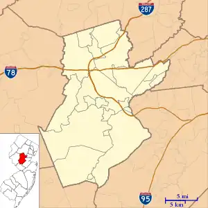
 Middlebush Location in Somerset County  Middlebush Location in New Jersey  Middlebush Location in the United States | |
| Coordinates: 40°30′21″N 74°32′00″W / 40.505696°N 74.53337°W[1][2] | |
| Country | |
| State | |
| County | Somerset |
| Township | Franklin |
| Area | |
| • Total | 1.99 sq mi (5.16 km2) |
| • Land | 1.99 sq mi (5.15 km2) |
| • Water | 0.00 sq mi (0.00 km2) 0.07% |
| Elevation | 138 ft (42 m) |
| Population | |
| • Total | 2,368 |
| • Density | 1,189.95/sq mi (459.51/km2) |
| Time zone | UTC−05:00 (Eastern (EST)) |
| • Summer (DST) | UTC−04:00 (Eastern (EDT)) |
| ZIP Code | |
| Area code(s) | 609/640 and 732/848 |
| FIPS code | 34-45870[1][2][7] |
| GNIS feature ID | 02584011[1][2] |
.jpg.webp)
Middlebush is an unincorporated community and census-designated place (CDP)[8] located in Franklin Township, in Somerset County, in the U.S. state of New Jersey.[9][10][11][12] As of the 2010 United States Census, the CDP's population was 2,326.[13] It is perhaps most distinguished as being the host section for Franklin Township's municipal complex.
Middlebush still has a rural feel with 19th-century homes and tree-lined streets. Middlebush was once a stop on the Millstone and New Brunswick Railroad, and this legacy is evident in the street named Railroad Avenue that presently has no railroad tracks in sight.[14]
Geography
According to the United States Census Bureau, Middlebush had a total area of 1.990 square miles (5.155 km2), including 1.989 square miles (5.151 km2) of land and 0.001 square miles (0.004 km2) of water (0.07%).[1][2]
Demographics
| Census | Pop. | Note | %± |
|---|---|---|---|
| 2010 | 803 | — | |
| 2020 | 2,368 | 194.9% | |
| Population sources: 2010[13] 2020[5] | |||
2010 census
The 2010 United States census counted 2,326 people, 834 households, and 592 families in the CDP. The population density was 1,169.6 per square mile (451.6/km2). There were 868 housing units at an average density of 436.4 per square mile (168.5/km2). The racial makeup was 62.81% (1,461) White, 12.64% (294) Black or African American, 0.17% (4) Native American, 20.03% (466) Asian, 0.00% (0) Pacific Islander, 1.72% (40) from other races, and 2.62% (61) from two or more races. Hispanic or Latino of any race were 6.92% (161) of the population.[13]
Of the 834 households, 34.3% had children under the age of 18; 63.2% were married couples living together; 5.5% had a female householder with no husband present and 29.0% were non-families. Of all households, 25.5% were made up of individuals and 17.5% had someone living alone who was 65 years of age or older. The average household size was 2.77 and the average family size was 3.40.[13]
24.6% of the population were under the age of 18, 6.0% from 18 to 24, 23.9% from 25 to 44, 30.4% from 45 to 64, and 15.1% who were 65 years of age or older. The median age was 42.6 years. For every 100 females, the population had 97.3 males. For every 100 females ages 18 and older there were 92.0 males.[13]
Points of interest
- Middlebush Reformed Church
- Middlebush Park is Franklin Township's newest municipal park. Located in Middlebush, off DeMott Lane, the park hosts ballfields and a children's playground.
- Stage House Tavern was Colonial Farms, which now houses the restaurant.
- Middlebush Giant was a circus performer and sideshow attraction who retired to a farm in Middlebush.
- Cedar Grove Cemetery, Franklin is located off Amwell Avenue and contains the body of the Middlebush Giant.
- Middlebush Volunteer Fire Department[15]
Historic district
The Middlebush Village Historic District was added to the National Register of Historic Places on April 24, 2007.
References
- 1 2 3 4 Gazetteer of New Jersey Places, United States Census Bureau. Accessed July 21, 2016.
- 1 2 3 4 US Gazetteer files: 2010, 2000, and 1990, United States Census Bureau. Accessed September 4, 2014.
- ↑ "ArcGIS REST Services Directory". United States Census Bureau. Retrieved October 11, 2022.
- ↑ U.S. Geological Survey Geographic Names Information System: Middlebush Census Designated Place, Geographic Names Information System. Accessed August 23, 2012.
- 1 2 Census Data Explorer: Middlebush CDP, New Jersey, United States Census Bureau. Accessed June 15, 2023.
- ↑ Look Up a ZIP Code for Middlebush, NJ, United States Postal Service. Accessed February 12, 2013.
- ↑ Geographic Codes Lookup for New Jersey, Missouri Census Data Center. Accessed June 9, 2023.
- ↑ State of New Jersey Census Designated Places - BVP20 - Data as of January 1, 2020, United States Census Bureau. Accessed December 1, 2022.
- ↑ GCT-PH1 - Population, Housing Units, Area, and Density: 2010 - County -- County Subdivision and Place from the 2010 Census Summary File 1 for Somerset County, New Jersey Archived 2020-02-12 at archive.today, United States Census Bureau. Accessed February 11, 2013.
- ↑ 2006-2010 American Community Survey Geography for New Jersey, United States Census Bureau. Accessed February 11, 2013.
- ↑ New Jersey: 2010 - Population and Housing Unit Counts - 2010 Census of Population and Housing (CPH-2-32), United States Census Bureau, August 2012. Accessed February 11, 2013.
- ↑ Locality Search, State of New Jersey. Accessed April 19, 2015.
- 1 2 3 4 5 DP-1 - Profile of General Population and Housing Characteristics: 2010 Demographic Profile Data for Middlebush CDP, New Jersey Archived 2020-02-12 at archive.today, United States Census Bureau. Accessed February 11, 2013.
- ↑ William B. Brahms (1997). Franklin Township, Somerset County, NJ: A History. Arcadia Publishing. ISBN 0-9668586-0-3.
- ↑ Middlebush Volunteer Fire Department
