Ocurí Municipality | |
|---|---|
Municipality | |
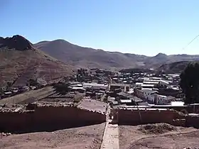 Ocurí | |
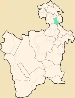 Location within Potosí Department | |
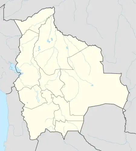 Ocurí Municipality Location within Bolivia | |
| Coordinates: 18°50′S 65°48′W / 18.833°S 65.800°W | |
| Country | |
| Department | Potosí Department |
| Province | Chayanta Province |
| Seat | Ocurí |
| Area | |
| • Total | 304 sq mi (788 km2) |
| Elevation | 13,500 ft (4,100 m) |
| Population (2001) | |
| • Total | 18,516 |
| • Ethnicities | Quechua |
| Time zone | UTC-4 (BOT) |
Ocurí Municipality is the fourth municipal section of the Chayanta Province in the Potosí Department in Bolivia. Its seat is Ocurí.
Subdivision
The municipality consists of the following cantons:
- Chairapata
- Maragua
- Marcoma
- Ocurí
The people
The people are predominantly indigenous citizens of Quechua descent.[1]
| Ethnic group | % |
|---|---|
| Quechua | 93.4 |
| Aymara | 0.2 |
| Guaraní, Chiquitos, Moxos | 0.2 |
| Not indigenous | 6.1 |
| Other indigenous groups | 0.1 |
Notable people
- Emeliana Aiza (born 1980) - politician
See also
References
- ↑ obd.descentralizacion.gov.bo/municipal/fichas/ (inactive)
External links
Capital: Potosí | ||
| Provinces |  | |
| Municipalities (and seats) |
| |
This article is issued from Wikipedia. The text is licensed under Creative Commons - Attribution - Sharealike. Additional terms may apply for the media files.