Okrúhle | |
|---|---|
Municipality | |
 | |
 Okrúhle Location of Okrúhle in the Prešov Region  Okrúhle Location of Okrúhle in Slovakia | |
| Coordinates: 49°12′N 21°33′E / 49.200°N 21.550°E | |
| Country | |
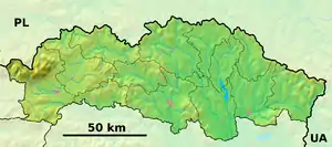
| Region | Prešov |
| District | Svidník |
| First mentioned | 1414 |
| Area | |
| • Total | 14.964 km2 (5.778 sq mi) |
| Elevation | 220 m (720 ft) |
| Population | |
| • Total | 640 |
| • Density | 43/km2 (110/sq mi) |
| Time zone | UTC+1 (CET) |
| • Summer (DST) | UTC+2 (CEST) |
| Postal code | 090 42 |
| Area code | +421-54 |
| Car plate | SK |
| Website | www |
Okrúhle (Hungarian: Kerekrét; Rusyn: Округле) is a village and municipality in Svidník District in the Prešov Region of north-eastern Slovakia.
History
In historical records the village was first mentioned in 1414.
Geography
The municipality lies at an altitude of 220 metres and covers an area of 14.964 km². It has a population of about 640 people.
External links
 Media related to Okrúhle at Wikimedia Commons
- Official website

- https://web.archive.org/web/20070513023228/http://www.statistics.sk/mosmis/eng/run.html
This article is issued from Wikipedia. The text is licensed under Creative Commons - Attribution - Sharealike. Additional terms may apply for the media files.