Oldeholtwolde | |
|---|---|
Village | |
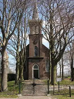 Oldeholtwolde Church | |
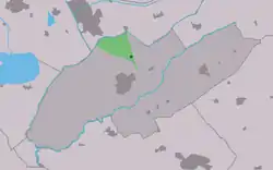 Location in Weststellingwerf municipality | |
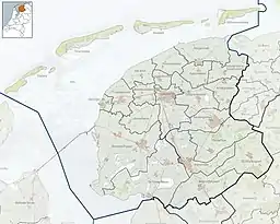 Oldeholtwolde Location in the Netherlands  Oldeholtwolde Oldeholtwolde (Netherlands) | |
| Coordinates: 52°53′8″N 5°57′18″E / 52.88556°N 5.95500°E | |
| Country | |
| Province | |
| Municipality | |
| Area | |
| • Total | 10.23 km2 (3.95 sq mi) |
| Elevation | −0.2 m (−0.7 ft) |
| Population (2021)[1] | |
| • Total | 155 |
| • Density | 15/km2 (39/sq mi) |
| Postal code | 8477[1] |
| Dialing code | 0561 |
Oldeholtwolde (West Frisian: Aldeholtwâlde) is a village in Weststellingwerf in the province of Friesland, the Netherlands. It had a population of around 150 in 2017.[3]
The village was first mentioned in 1320 as Oldeholtwolt, and means "old low-lying wood". Olde (old) has been added to distinguish from Nijeholtwolde.[4] The Dutch Reformed church was destroyed in a storm around 1700. A new church was built in 1875.[5][6]
In 1840, Oldeholtwolde was home to 149 people.[6]
References
- 1 2 3 "Kerncijfers wijken en buurten 2021". Central Bureau of Statistics. Retrieved 2 April 2022.
- ↑ "Postcodetool for 8477AA". Actueel Hoogtebestand Nederland (in Dutch). Het Waterschapshuis. Retrieved 2 April 2022.
- ↑ Villages - Weststellingwerf municipality (in Dutch)
- ↑ "Oldeholtwolde - (geografische naam)". Etymologiebank (in Dutch). Retrieved 2 April 2022.
- ↑ Ronald Stenvert & Sabine Broekhoven (2000). "Oldeholtpade" (in Dutch). Zwolle: Waanders. ISBN 90 400 9476 4. Retrieved 2 April 2022.
- 1 2 "Oldeholtwolde". Plaatsengids (in Dutch). Retrieved 2 April 2022.
External links
![]() Media related to Oldeholtwolde at Wikimedia Commons
Media related to Oldeholtwolde at Wikimedia Commons
This article is issued from Wikipedia. The text is licensed under Creative Commons - Attribution - Sharealike. Additional terms may apply for the media files.