Oliver, Georgia | |
|---|---|
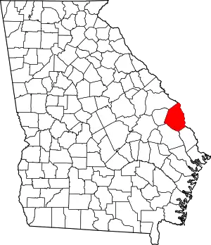
 Location in Screven County and the state of Georgia | |
| Coordinates: 32°31′20″N 81°31′57″W / 32.52222°N 81.53250°W | |
| Country | United States |
| State | Georgia |
| County | Screven |
| Area | |
| • Total | 0.94 sq mi (2.43 km2) |
| • Land | 0.93 sq mi (2.41 km2) |
| • Water | 0.01 sq mi (0.02 km2) |
| Elevation | 115 ft (35 m) |
| Population (2020) | |
| • Total | 210 |
| • Density | 226.05/sq mi (87.30/km2) |
| Time zone | UTC-5 (Eastern (EST)) |
| • Summer (DST) | UTC-4 (EDT) |
| ZIP code | 30449 |
| Area code | 912 |
| FIPS code | 13-58100[2] |
| GNIS feature ID | 0332571[3] |
Oliver is a city in Screven County, Georgia, United States. The population was 210 as of 2020.
Geography
Oliver is located at 32°31′20″N 81°31′57″W / 32.52222°N 81.53250°W (32.522176, -81.532458).[4]
According to the United States Census Bureau, the city has a total area of 0.9 square miles (2.3 km2), all land.
Demographics
| Census | Pop. | Note | %± |
|---|---|---|---|
| 1910 | 243 | — | |
| 1920 | 288 | 18.5% | |
| 1930 | 242 | −16.0% | |
| 1940 | 211 | −12.8% | |
| 1950 | 223 | 5.7% | |
| 1960 | 192 | −13.9% | |
| 1970 | 217 | 13.0% | |
| 1980 | 239 | 10.1% | |
| 1990 | 242 | 1.3% | |
| 2000 | 253 | 4.5% | |
| 2010 | 239 | −5.5% | |
| 2020 | 210 | −12.1% | |
| U.S. Decennial Census[5] | |||
As of the census[2] of 2000, there were 253 people, 97 households, and 76 families residing in the city. By 2020, its population declined to 210.
References
- ↑ "2020 U.S. Gazetteer Files". United States Census Bureau. Retrieved December 18, 2021.
- 1 2 "U.S. Census website". United States Census Bureau. Retrieved January 31, 2008.
- ↑ "US Board on Geographic Names". United States Geological Survey. October 25, 2007. Retrieved January 31, 2008.
- ↑ "US Gazetteer files: 2010, 2000, and 1990". United States Census Bureau. February 12, 2011. Retrieved April 23, 2011.
- ↑ "Census of Population and Housing". Census.gov. Retrieved June 4, 2015.
This article is issued from Wikipedia. The text is licensed under Creative Commons - Attribution - Sharealike. Additional terms may apply for the media files.
