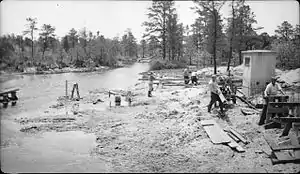
June 1939 WPA construction project on the Oswego River at the CR 679 overpass near Harrisville, New Jersey and just southwest of Harrisville Lake and Harrisville Dam.

View of the August 20, 1939 Oswego River flood at Harrisville, New Jersey as seen from where Chatsworth Rd/County Route 679 crosses the Oswego River. The 1939 flood occurred despite the Harrisville Dam being in place since 1932.
The Oswego River is a 23.7-mile-long (38.1 km)[1] tributary of the Wading River in the southern New Jersey Pine Barrens in the United States.[2]
See also
References
- ↑ U.S. Geological Survey. National Hydrography Dataset high-resolution flowline data. The National Map, accessed April 1, 2011
- ↑ Gertler, Edward. Garden State Canoeing, Seneca Press, 2002. ISBN 0-9605908-8-9
External links
39°45′37″N 74°25′30″W / 39.760246°N 74.42511°W
This article is issued from Wikipedia. The text is licensed under Creative Commons - Attribution - Sharealike. Additional terms may apply for the media files.