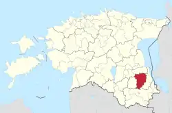
Põlva Parish
Põlva vald | |
|---|---|
 | |
 Flag  Coat of arms | |
 Põlva Parish within Põlva County. | |
| Country | Estonia |
| County | Põlva County |
| Administrative centre | Põlva |
| Area | |
| • Total | 706 km2 (273 sq mi) |
| Population | |
| • Total | 14,600 |
| • Density | 21/km2 (54/sq mi) |
| ISO 3166 code | EE-622 |
| Website | www |
Põlva Parish (Estonian: Põlva vald) is a rural municipality in Põlva County, southeastern Estonia.
On 1 January 2009, it had a population of 3,882 and an area of 228.63 km².[1] In October 2013, the town of Põlva (formerly a separate municipality) was merged into Põlva Parish, becoming the centre of it. In 2017, as part of the administrative reform, the neighbouring Ahja, Laheda, Mooste and Vastse-Kuuste parishes were merged with Põlva Parish.
Settlements
- Town
- Põlva
- Small boroughs
- Ahja - Mooste - Vastse-Kuuste
- Villages
- Aarna - Adiste - Akste - Andre - Eoste - Himma - Himmaste - Holvandi - Ibaste - Jaanimõisa - Joosu - Kaaru - Kadaja - Kanassaare - Karilatsi - Kastmekoja - Kauksi - Kiidjärve - Kiisa - Kiuma - Koorvere - Kosova - Kähri - Kärsa - Lahe - Laho - Leevijõe - Logina - Loko - Lootvina - Lutsu - Mammaste - Meemaste - Metste - Miiaste - Mustajõe - Mustakurmu - Mõtsküla - Naruski - Nooritsmetsa - Orajõe - Padari - Partsi - Peri - Pragi - Puskaru - Puuri - Rasina - Roosi - Rosma - Savimäe - Soesaare - Suurküla - Suurmetsa - Säkna - Säässaare - Taevaskoja - Terepi - Tilsi - Tromsi - Tännassilma - Uibujärve - Valgemetsa - Valgesoo - Vana-Koiola - Vanaküla - Vanamõisa - Vardja - Viisli - Vooreküla[2]

Kähri Orthodox Church (2013)
Religion
References
- ↑ "Population figure and composition". Statistics Estonia. Retrieved 27 January 2010.
- ↑ "Eesti asustusüksused" [Populated places of Estonia]. Place Names Board of Estonia (in Estonian). Institute of the Estonian Language. 15 February 2010. Retrieved 13 May 2015.
External links
- Official website (in Estonian)
58°2′32″N 27°3′57″E / 58.04222°N 27.06583°E
This article is issued from Wikipedia. The text is licensed under Creative Commons - Attribution - Sharealike. Additional terms may apply for the media files.