| Pagelsburg | |
|---|---|
 Pagelsburg | |
| Highest point | |
| Elevation | 545 m above sea level (NN) (1,788 ft) |
| Prominence | 22 m ↓ Adlerbergweg |
| Isolation | 0.32 km → Großer Knollen |
| Coordinates | 51°40′20″N 10°25′07″E / 51.6723°N 10.4186°E |
| Geography | |
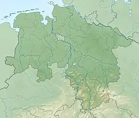
| Location | south of Sieber, Göttingen district, Lower Saxony, |
| Parent range | Harz Mountains |
The Pagelsburg is a hill in the Harz Mountains of central Germany, which lies south of Sieber in the district of Göttingen in Lower Saxony. It is 545 m above sea level (NN)[1] and lies 1.2 km south of the Adlersberg, 0.9 kilometres east of the Höxterberg and 1.0 kilometre northwest of the Großer Knollen.
Literature
- Kurt Mohr: Sammlung Geologischer Führer Band 58, Harz Westlicher Teil, 5th edition, Stuttgart 1998, ISBN 3-443-15071-3, pages 146-147
References
- ↑ Measurement with a barometric altimeter using as a reference point the nearby point 523.0 m from this map: Niedersächsisches Landesverwaltungsamt, Landesvermessung, ed. (1978), Topographische Karte 1:25000, 4328 Bad Lauterberg im Harz (in German), Hannover
{{citation}}: CS1 maint: location missing publisher (link)
This article is issued from Wikipedia. The text is licensed under Creative Commons - Attribution - Sharealike. Additional terms may apply for the media files.