Palamut | |
|---|---|
 Palamut Location in Turkey  Palamut Palamut (Marmara) | |
| Coordinates: 40°45′29″N 027°09′26″E / 40.75806°N 27.15722°E | |
| Country | Turkey |
| Province | Tekirdağ |
| District | Şarköy |
| Elevation | 350 m (1,150 ft) |
| Population (2022) | 30 |
| Time zone | TRT (UTC+3) |
| Postal code | 59800 |
| Area code | 0282 |
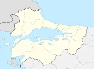
Palamut (Greek: Δρυϊνοχώρι Dryïnochṓri[1]) is a neighbourhood of the municipality and district of Şarköy, Tekirdağ Province, Turkey.[2] Its population is 30 (2022).[3] It is thirty kilometres from the town of Şarköy.
The primarily occupation is as a farmer. The population of the village has been declining. In 1985 it was 113,[4] in 1997 it was 65,[5] and as of 2022, the population was 30.[3]
| Year | Pop. | ±% p.a. |
|---|---|---|
| 1985 | 113 | — |
| 1990 | 93 | −3.82% |
| 1997 | 65 | −4.99% |
| 2007 | 51 | −2.40% |
| 2012 | 43 | −3.35% |
| 2017 | 46 | +1.36% |
| 2022 | 30 | −8.19% |
| Source: 1985 census,[4] 1990 census,[6] 1997 census[5] and TÜIK (2007-2022)[3] | ||
References
- ↑ Greek exonyms; from the National Census of Greek Kingdom 1920-1921
- ↑ Mahalle, Turkey Civil Administration Departments Inventory. Retrieved 19 September 2023.
- 1 2 3 "Population Of Municipalities, Villages And Quarters". TÜIK. Retrieved 29 September 2023.
- 1 2 "1985 General Census" (PDF) (in Turkish). Turkish Statistical Institute. 1986. Archived (PDF) from the original on 22 May 2021.
- 1 2 "1997 Population Count" (PDF) (in Turkish). Turkish Statistical Institute. 1999. Archived (PDF) from the original on 30 October 2022.
- ↑ "1990 General Census" (PDF) (in Turkish). Turkish Statistical Institute. 1991. Archived (PDF) from the original on 31 August 2021.
This article is issued from Wikipedia. The text is licensed under Creative Commons - Attribution - Sharealike. Additional terms may apply for the media files.