| Pascoe Vale Melbourne, Victoria | |||||||||||||||
|---|---|---|---|---|---|---|---|---|---|---|---|---|---|---|---|
 St Oliver Plunkett Catholic Church in Pascoe Vale | |||||||||||||||
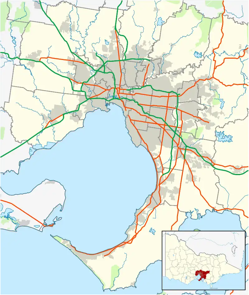
 Pascoe Vale Location in metropolitan Melbourne | |||||||||||||||
| Coordinates | 37°43′37″S 144°56′31″E / 37.727°S 144.942°E | ||||||||||||||
| Population | 18,171 (2021 census)[1] | ||||||||||||||
| • Density | 3,710/km2 (9,600/sq mi) | ||||||||||||||
| Postcode(s) | 3044 | ||||||||||||||
| Elevation | 45 m (148 ft) | ||||||||||||||
| Area | 4.9 km2 (1.9 sq mi) | ||||||||||||||
| Location | 9 km (6 mi) N of Melbourne | ||||||||||||||
| LGA(s) | City of Merri-bek | ||||||||||||||
| State electorate(s) | Pascoe Vale | ||||||||||||||
| Federal division(s) | Wills | ||||||||||||||
| |||||||||||||||
Pascoe Vale is a suburb in Melbourne, Victoria, Australia, 9 km (5.6 mi) north of Melbourne's central business district, located within the City of Merri-bek local government area. Pascoe Vale recorded a population of 18,171 at the 2021 census.[1]
History
Pascoe Vale was named after John Fawkner's property "Pascoeville", which was originally a holding of 709 acres (2.87 km2).[2] The property, established in 1839, was bounded by the Moonee Ponds Creek to the west, Gaffney Street to the south, Northumberland Road to the east and Rhodes Parade to the north. John Pascoe Fawkner built a timber house overlooking the creek, in the Marie Street area of Oak Park.
Pascoe Vale Post Office opened on 25 September 1911. A Pascoe Vale West Post Office opened in 1927 and closed in 1976.[3]
Pascoe Vale Road in the mid-19th century was originally called Sydney Road. For much of the 19th century, where a fast food chicken outlet in Pascoe Vale Road now exists, was once a Cobb & Co waystation. Ironically, during much of the 20th century, the same location was a chicken farm.
In 1841, Dr Farquhar McCrae, a wealthy surgeon, bought land in Pascoe Vale South, where he built his house in 1842–1843. This house is now known as Wentworth House, and is the oldest known private dwelling in Victoria still standing on its original site, and the fifth oldest building in Victoria.[4]
Several locally significant historic buildings and precincts exist within the suburb, including the Turner Street Precinct and Gavin Park and the Westbreen Creek Precinct, which contain collections of substantially intact inter-War and post-war houses constructed in the 19th century.[5]
Demographics
According to data from the 2016 census, Pascoe Vale recorded a population of 17,051 people. This is slightly more than the recorded number of residents in the 2001 Census Data, where 13,210 people were recorded as living in Pascoe Vale. The suburb has historically been less culturally diverse compared to other suburbs in Merri-bek. A lower proportion of Pascoe Vale residents were born overseas and Pascoe Vale has the highest proportion of Australian-born citizens. 58.7% of people living in Pascoe Vale speak English at home, which is lower than the metropolitan average, but higher than the average in Merri-bek. Other languages spoken at home included Italian 8.3%, Arabic 3.9%, Greek 3.8%, Mandarin 1.9%, and Urdu 1.7%.
According to the 2016 census, 62.2% of people in Pascoe Vale were born in Australia. Other countries of birth included Italy, which accounted for 4.4% of the population, followed by India 3.3%, England 1.7%, Pakistan 1.6%, and Greece 1.5%.[6]
The most common responses for religion in Pascoe Vale were Catholic 34.1%, no religion, so described 25.4%, not stated 9.6%, Islam 7.7%, and Eastern Orthodox 6.0%. In Pascoe Vale, Christianity was the largest religious group reported overall (56.7%) (this figure excludes not stated responses).
Transport
Public transport services within Pascoe Vale include access to heavy rail, light rail and buses.
Bus
Six bus routes service Pascoe Vale:[7]
- 513 : Eltham station – Glenroy station via Lower Plenty. Operated by Dysons.[8]
- 514 : Eltham station – Glenroy station via Greensborough. Operated by Dysons.[9]
- 527 : Gowrie station – Northland Shopping Centre via Murray Road. Operated by Ventura Bus Lines.[10]
- 542 : Roxburgh Park station – Pascoe Vale station via Meadow Heights, Broadmeadows and Glenroy. Operated by Dysons.[11]
- 561 : Macleod – Pascoe Vale station via La Trobe University. Operated by Dysons.[12]
- Night Bus 951 : Brunswick station – Glenroy station via West Coburg (operates Saturday and Sunday mornings only). Operated by Ventura Bus Lines.[13]
Cycling
Arterial cycling access is provided via the Moonee Ponds Creek Trail, Sussex Street, and Gaffney Street. In 2020, VicRoads announced a project to provide safer cycling infrastructure in Pascoe Vale, including upgrades to bicycle lanes and six intersections between Boundary Road and O'Hea Street.[14]
Train
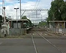
Pascoe Vale railway station, which is located on the Craigieburn line. This provides northbound access to major activity centres in Broadmeadows and Craigieburn, and southbound access to major activity centres in Essendon, North Melbourne (including rail interchange options along the Sunbury, Upfield, Werribee and Williamstown lines) and the Melbourne CBD.
Tram
Light rail service is provided by tram route 58, which terminates at Bell Street, Pascoe Vale South. This provides access to Brunswick West, Melbourne CBD and terminates in Toorak.
Politics
Pascoe Vale is located in the federal electorate of Wills, and is historically a safe Australian Labor Party seat. The electorate has been held by Peter Khalil since 2016.
The seat was held between 1980 and 1992 by former Prime Minister, Bob Hawke. From 1992 to 1996, the seat was held by independent Phil Cleary, the only non-Labor candidate to hold the electorate.
The state electorate of Pascoe Vale is currently held by the ALP's Anthony Cianflone, who won the seat at the 2022 Victorian state election. From 2014 to 2022, the seat was held by the ALP's Lizzie Blandthorn, who is the goddaughter of her predecessor and former Community Services minister Christine Campbell.
Parks and gardens
Pascoe Vale is known for its many parks and gardens, including Cole Reserve, Austin Reserve, Kelvin Thomson Reserve and Gavin Park.
The Moonee Ponds Creek is the major stormwater canal in the area and flows through several of its parks and gardens.
Managed by the City of Merri-bek, the Pascoe Vale Swimming Pool, on Prospect Street, is a popular venue during summer.

Shops and nightlife

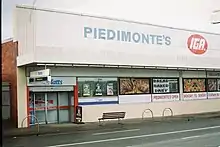
Pascoe Vale accommodates several cafés, restaurants, bakeries and takeaway shops, which are largely located in neighbourhood centres at Pascoe Vale railway station, along Gaffney Street, Kent Road, Cumberland Road, Bell Street and Sussex Street.
Late night venues include the Pascoe Vale Hotel, Pascoe Vale RSL and District Bottle Store.
Educational facilities
- Pascoe Vale Girls' College
- Westbreen Primary School
- Pascoe Vale Primary School
- Pascoe Vale North Primary School
- St. Oliver Plunkett Primary School
- Pascoe Vale South Primary School
- St Francis de Sales (Pascoe Vale Road)
Sporting clubs
- Pascoe Vale Soccer Club plays in the National Premier League Victoria, which is the second tier in Australia.[15]
- Pascoe Vale Football Club, an Australian Rules football team, competes in the Essendon District Football League.[16]
- Pascoe Vale Cricket Club has been one of the more successful and enduring cricket clubs in the region, having won a number of junior and senior premierships since 1936. Its two A-Grade premierships of 1990/91 and 1991/92 were teams said to have been able to compete on a District Cricket level, such was the talent and ability in the teams, which contained district cricketers of the like of Neil Howard, Bill McGowan and Gus Gilmour.
- Coburg Districts Football Club
- St Andrews Cricket Club
- Park Panthers Netball Club
- Pascoe Vale Ice Fighters
See also
- City of Broadmeadows – Parts of Pascoe Vale were previously within this former local government area.
- City of Coburg – Parts of Pascoe Vale were previously within this former local government area.
References
- 1 2 Australian Bureau of Statistics (28 June 2022). "Pascoe Vale (Suburbs and Localities)". 2021 Census QuickStats. Retrieved 2 July 2022.
- ↑ "Pascoe Vale", Victorian Places, Victorian Places, retrieved 31 July 2022
- ↑ Premier Postal History, Post Office List, retrieved 11 April 2008
- ↑ "History of Coburg and Pascoe Vale – Merri-bek City Council, Victoria, Australia". 6 August 2012. Archived from the original on 6 August 2012. Retrieved 18 May 2021.
- ↑ Allom Lovell & Associates (8 May 2021). "City of Merri-bek Heritage Review – Heritage Overlay Precincts" (PDF). 3: 185.
{{cite journal}}: Cite journal requires|journal=(help) - ↑ Australian Bureau of Statistics (27 June 2017). "Pascoe Vale (State Suburb)". 2016 Census QuickStats. Retrieved 3 July 2017.
- ↑ "The Melbourne Transport Map". melbournetransportmap.com. Retrieved 27 April 2021.
- ↑ "513 Eltham - Glenroy via Lower Plenty". Public Transport Victoria.
- ↑ 514 Eltham - Glenroy via Greensborough Public Transport Victoria
- ↑ "527 Gowrie - Northland via Murray Road". Public Transport Victoria.
- ↑ "542 Roxburgh Park - Pascoe Vale via Meadow Heights & Broadmeadows & Glenroy". Public Transport Victoria.
- ↑ "561 Macleod - Pascoe Vale via La Trobe University". Public Transport Victoria.
- ↑ 951 Brunswick Station - Glenroy Station via West Coburg Public Transport Victoria
- ↑ "Safer cycling route for Pascoe Vale". VicRoads. 8 June 2020. Retrieved 27 April 2021.
- ↑ "Archived copy". Archived from the original on 21 August 2011. Retrieved 20 April 2011.
{{cite web}}: CS1 maint: archived copy as title (link) - ↑ Full Points Footy, Pascoe Vale, retrieved 15 April 2009
