Patoka Township | |
|---|---|
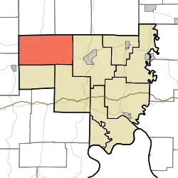 Location of Patoka Township in Crawford County | |
| Coordinates: 38°21′18″N 86°36′23″W / 38.35500°N 86.60639°W | |
| Country | United States |
| State | Indiana |
| County | Crawford |
| Named for | Patoka River or Patoka Lake, both located within the township. |
| Government | |
| • Type | Indiana township |
| Area | |
| • Total | 45.65 sq mi (118.2 km2) |
| • Land | 43.65 sq mi (113.1 km2) |
| • Water | 2 sq mi (5 km2) |
| Elevation | 709 ft (216 m) |
| Population (2010) | |
| • Total | 1,579 |
| • Density | 36.2/sq mi (14.0/km2) |
| FIPS code | 18-58284[2] |
| GNIS feature ID | 453707 |
Patoka Township is one of nine townships in Crawford County, Indiana, United States. As of the 2010 census, its population was 1,579 and it contained 1,076 housing units.[3]
Geography
According to the 2010 census, the township has a total area of 45.65 square miles (118.2 km2), of which 43.65 square miles (113.1 km2) (or 95.62%) is land and 2 square miles (5.2 km2) (or 4.38%) is water.[3]
Unincorporated towns
(This list is based on USGS data and may include former settlements.)
Adjacent townships
- Jackson Township, Orange County (north)
- Greenfield Township, Orange County (northeast)
- Sterling Township (east)
- Union Township (southeast)
- Jefferson Township, Dubois County (southwest)
- Johnson Township (southwest)
- Hall Township, Dubois County (west)
Major highways
Cemeteries
The township contains four cemeteries: Brown, Eckerty, Mount Eden and Williams.
References
- ↑ "US Board on Geographic Names". United States Geological Survey. October 25, 2007. Retrieved January 31, 2008.
- ↑ "U.S. Census website". United States Census Bureau. Retrieved January 31, 2008.
- 1 2 "Population, Housing Units, Area, and Density: 2010 - County -- County Subdivision and Place -- 2010 Census Summary File 1". United States Census. Archived from the original on February 12, 2020. Retrieved May 10, 2013.
External links
Wikimedia Commons has media related to Patoka Township, Crawford County, Indiana.
Municipalities and communities of Crawford County, Indiana, United States | ||
|---|---|---|
| Towns | Map of Indiana highlighting Crawford County | |
| Townships | ||
| CDPs | ||
| Other communities | ||
| Footnotes | ‡This populated place also has portions in an adjacent county or counties | |
This article is issued from Wikipedia. The text is licensed under Creative Commons - Attribution - Sharealike. Additional terms may apply for the media files.