Peniel, West Virginia | |
|---|---|
 Peniel, West Virginia  Peniel, West Virginia | |
| Coordinates: 38°49′38″N 81°28′03″W / 38.82722°N 81.46750°W | |
| Country | United States |
| State | West Virginia |
| County | Roane |
| Elevation | 725 ft (221 m) |
| Time zone | UTC-5 (Eastern (EST)) |
| • Summer (DST) | UTC-4 (EDT) |
| Area code(s) | 304 & 681 |
| GNIS feature ID | 1549871[1] |
Peniel is an unincorporated community in Roane County, West Virginia, United States. Peniel is located along the Middle Fork Reedy Creek on U.S. Route 33,[2] 6.5 miles (10.5 km) west-northwest of Spencer.
References
- ↑ U.S. Geological Survey Geographic Names Information System: Peniel, West Virginia
- ↑ West Virginia Atlas & Gazetteer. Yarmouth, Me.: DeLorme. 1997. p. 33. ISBN 0-89933-246-3.
Municipalities and communities of Roane County, West Virginia, United States | ||
|---|---|---|
| City | 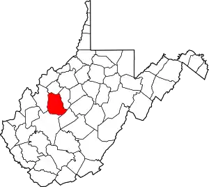 Map of West Virginia highlighting Roane County | |
| Town | ||
| Unincorporated communities |
| |
| Ghost towns | ||
| Footnotes | ‡This populated place also has portions in an adjacent county or counties | |
This article is issued from Wikipedia. The text is licensed under Creative Commons - Attribution - Sharealike. Additional terms may apply for the media files.