Penton, New Jersey | |
|---|---|
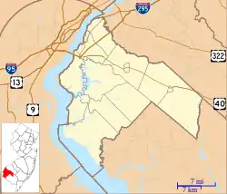
 Penton, New Jersey Penton's location in Salem County (Inset: Salem County in New Jersey)  Penton, New Jersey Penton, New Jersey (New Jersey)  Penton, New Jersey Penton, New Jersey (the United States) | |
| Coordinates: 39°34′42″N 75°24′06″W / 39.57833°N 75.40167°W | |
| Country | |
| State | |
| County | Salem |
| Township | Alloway |
| Named for | Daniel or Abner Penton |
| Elevation | 10 m (33 ft) |
| Time zone | UTC−05:00 (Eastern (EST)) |
| • Summer (DST) | UTC−04:00 (EDT) |
| GNIS feature ID | 879226[1] |
Penton is an unincorporated community located within Alloway Township in Salem County, in the U.S. state of New Jersey.[2] The community is the site of the historic Penton Chapel.[3][4]
History
William Penton received 500 acres (200 ha) of land from John Fenwick. William and Daniel Penton lived on a section of this land. The area was later named after a Penton family member (either Daniel or Abner), and was known as Penton Abbey, Pentonville, and Penton.[5] Burton Penton, who died there around 1795, stated Guineatown was the name of the village. His granddaughter suggested the name Penton when the post office was established.[6]
The village was known for its brickyards. Some early ones were established by Jacob Thackra, John Bee, and Smith B. Sickler.[7][8]
An 1834 survey suggested the town was mostly inhabited by African Americans.[9]
References
- ↑ U.S. Geological Survey Geographic Names Information System: Penton, New Jersey
- ↑ Locality Search, State of New Jersey.
- ↑ Penton Chapel
- ↑ Penton Chapel, New Jersey Churcscape
- ↑ Hutchinson, Viola L. The Origin of New Jersey Place Names, New Jersey Public Library Commission, May 1945. Accessed November 14, 2015.
- ↑ Place Names of Salem County N.J., West Jersey History Project
- ↑ The Clay-worker, Volumes 41-42
- ↑ Towns and County Names, Visit Salem County NJ
- ↑ Gordon, Thomas Francis (1834). "A Gazetteer of the State of New Jersey: Comprehending a General View of Its Physical and Moral Condition, Together with a Topographical and Statistical Account of Its Counties, Towns, Villages, Canals, Rail Roads, &c., Accompanied by a Map".
