| Perseverance Queensland | |||||||||||||||
|---|---|---|---|---|---|---|---|---|---|---|---|---|---|---|---|
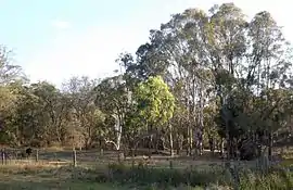
 Paddocks, 2014 | |||||||||||||||
 Perseverance | |||||||||||||||
| Coordinates | 27°22′10″S 152°06′11″E / 27.3694°S 152.1030°E | ||||||||||||||
| Population | 72 (SAL 2021)[1] | ||||||||||||||
| Postcode(s) | 4352 | ||||||||||||||
| Area | 11.4 km2 (4.4 sq mi) | ||||||||||||||
| Time zone | AEST (UTC+10:00) | ||||||||||||||
| Location |
| ||||||||||||||
| LGA(s) | Toowoomba Region | ||||||||||||||
| State electorate(s) | Condamine | ||||||||||||||
| Federal division(s) | Maranoa | ||||||||||||||
| |||||||||||||||
Perseverance is a rural locality in the Toowoomba Region, Queensland, Australia.[2] In the 2021 census, Perseverance had a population of 72 people.[3]
Geography
Perseverance is on the Darling Downs in southern Queensland.[4]
The locality is crossed from east to west by the Esk–Hampton Road. Upper Creekbrook Creek forms part of the eastern boundary of Perseverance.[4]
The land use is predominantly grazing on native vegetation.[4]
History
Perseverance Creek Provisional School opened on 10 November 1880. On 1 January 1909, it became Perseverance Creek State School. It closed briefly in 1925 to 1926 due to low student numbers. It permanently closed in 1944.[5]
All Saints Catholic Church opened on Sunday 29 August 1909 by the Reverend D. Fouhy.[6]
In 1914, land was purchased by the Methodists with the intention to build a church.[7][8] The church opened on 1 May 1915.[9]
Demographics
In the 2016 census, Perseverance had a population of 62 people.[10]
In the 2021 census, Perseverance had a population of 72 people.[3]
Education
There are no schools in Perseverance. The nearest government primary schools are Geham State School in Geham to the south-west and Murphy's Creek State School in Murphys Creek to the south. The nearest government secondary schools are Crow's Nest State School (to Year 10) in Crows Nest to the north and Highfields State Secondary College (to Year 12) in Highfields to the south-west.[11]
Amenities
Perseverance Hall is on the south-west corner of Esk Hampton Road and Perseverance Hall Road (27°22′42″S 152°07′05″E / 27.37846°S 152.11805°E).[12]
References
- ↑ Australian Bureau of Statistics (28 June 2022). "Perseverance (suburb and locality)". Australian Census 2021 QuickStats. Retrieved 28 June 2022.
- ↑ "Perseverance – locality in Toowoomba Region (entry 49254)". Queensland Place Names. Queensland Government. Retrieved 17 November 2019.
- 1 2 Australian Bureau of Statistics (28 June 2022). "Perseverance (SAL)". 2021 Census QuickStats. Retrieved 28 February 2023.
- 1 2 3 "Queensland Globe". State of Queensland. Retrieved 27 December 2023.
- ↑ Queensland Family History Society (2010), Queensland schools past and present (Version 1.01 ed.), Queensland Family History Society, ISBN 978-1-921171-26-0
- ↑ "NEW R.C. CHURCH". Darling Downs Gazette. Vol. LII, no. 8, 785. Queensland, Australia. 30 August 1909. p. 5. Retrieved 27 December 2023 – via National Library of Australia.
- ↑ "METHODIST SYNODS". The Brisbane Courier. No. 17, 721. Queensland, Australia. 31 October 1914. p. 16. Archived from the original on 11 September 2021. Retrieved 10 September 2021 – via National Library of Australia.
- ↑ "RELIGIOUS". The Brisbane Courier. No. 17, 607. Queensland, Australia. 20 June 1914. p. 5. Retrieved 27 December 2023 – via National Library of Australia.
- ↑ "CROW'S NEST". Darling Downs Gazette. No. 7605. Queensland, Australia. 8 May 1915. p. 5. Retrieved 27 December 2023 – via National Library of Australia.
- ↑ Australian Bureau of Statistics (27 June 2017). "Perseverance (SSC)". 2016 Census QuickStats. Retrieved 20 October 2018.
- ↑ "Layers: Locality; Schools and school catchments". Queensland Globe. Queensland Government. Archived from the original on 19 December 2017. Retrieved 27 December 2023.
- ↑ Google (27 December 2023). "Perseverance Hall" (Map). Google Maps. Google. Retrieved 27 December 2023.