Petropavlivka
Петропавлівка | |
|---|---|
Village | |
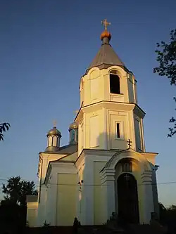
 Front of the Church of St. Peter and Paul | |
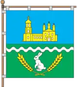
 Flag  Coat of arms | |
| Coordinates: 49°43′00″N 37°43′09″E / 49.71667°N 37.71917°E | |
| Country | |
| Oblast | |
| Raion | |
| Founded | 1686 |
| Government | |
| • Type | Petropavlivka rural hromada |
| Area | |
| • Total | 9,121 km2 (3,522 sq mi) |
| Elevation | 106 m (348 ft) |
| Population | |
| • Total | 2,452 |
| • Density | 0.27/km2 (0.70/sq mi) |
| Time zone | UTC+2 (EET) |
| • Summer (DST) | UTC+3 (EEST) |
| Postal code | 63722 |
| Area code | +380 5742 |
| KOATUU code | 6323785501 |
Petropavlivka (Ukrainian: Петропавлівка, Russian: Петропавловка, romanized: Petropavlovka) is a village in Kupiansk Raion, Kharkiv Oblast, Ukraine. The village is located about 110.4 kilometres (68.6 mi) east by south (EbS) of the centre of Kharkiv. The village also hosts the administration of the Petropavlivka rural hromada, one of the hromadas of Ukraine.
The settlement came under attack by Russian forces during the Russian invasion of Ukraine in 2022 and was regained by Ukrainian forces by the end of September the same year.[2]
See also
- List of nearby settlements
- Kupiansk
- Kucherivka
- Podoli
References
- ↑ "Офіційна сторінка Всеукраїнського перепису населення | Банк даних" [All-Ukrainian population census | Database]. ukrcensus.gov.ua (in Ukrainian). Retrieved 14 November 2022.
- ↑ Karolina Hird; George Barros; Frederick W. Kagan (24 September 2022). "Russian Offensive Campaign Assessment, September 24". understandingwar.org. ISW. Retrieved 21 November 2022.
These Russian claims are consistent with a statement made by the Ukrainian General Staff that Ukrainian troops repelled a Russian attack on Petropavlivka, /.../ Geolocated combat footage posted on September 23 showing Ukrainian forces destroying a Russian tank just east of Petropavlivka supports this assessment.
This article is issued from Wikipedia. The text is licensed under Creative Commons - Attribution - Sharealike. Additional terms may apply for the media files.