Pfaffenschlag bei Waidhofen a.d.Thaya | |
|---|---|
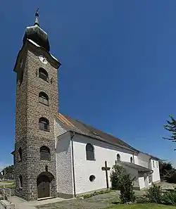 Pfaffenschlag parish church | |
 Coat of arms | |
 Pfaffenschlag bei Waidhofen a.d.Thaya Location within Austria | |
| Coordinates: 48°50′00″N 15°11′00″E / 48.83333°N 15.18333°E | |
| Country | Austria |
| State | Lower Austria |
| District | Waidhofen an der Thaya |
| Government | |
| • Mayor | Johannes Semper (ÖVP) |
| Area | |
| • Total | 29.67 km2 (11.46 sq mi) |
| Elevation | 570 m (1,870 ft) |
| Population (2018-01-01)[2] | |
| • Total | 913 |
| • Density | 31/km2 (80/sq mi) |
| Time zone | UTC+1 (CET) |
| • Summer (DST) | UTC+2 (CEST) |
| Postal code | 3834 |
| Area code | 02848 |
| Vehicle registration | WT |
| Website | www.pfaffenschlag.at |
Pfaffenschlag bei Waidhofen (completely: Pfaffenschlag bei Waidhofen an der Thaya, German pronunciation: [ˈp͡fafn̩ˌʃlaːk baɪ̯ ˌvaɪ̯tˈhoːfn̩ an deːɐ̯ ˈtaɪ] ⓘ) is a municipality in the district of Waidhofen an der Thaya in the Austrian state of Lower Austria.
Population
| Year | Pop. | ±% |
|---|---|---|
| 1971 | 1,193 | — |
| 1981 | 1,071 | −10.2% |
| 1991 | 970 | −9.4% |
| 2001 | 980 | +1.0% |
References
- ↑ "Dauersiedlungsraum der Gemeinden Politischen Bezirke und Bundesländer - Gebietsstand 1.1.2018". Statistics Austria. Retrieved 10 March 2019.
- ↑ "Einwohnerzahl 1.1.2018 nach Gemeinden mit Status, Gebietsstand 1.1.2018". Statistics Austria. Retrieved 9 March 2019.
External links
Wikimedia Commons has media related to Pfaffenschlag bei Waidhofen an der Thaya.
This article is issued from Wikipedia. The text is licensed under Creative Commons - Attribution - Sharealike. Additional terms may apply for the media files.