| Pico del Este | |
|---|---|
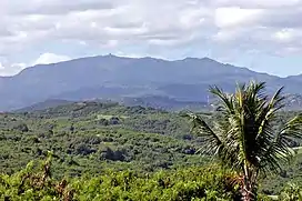
 Pico del Este as seen from the north. | |
| Highest point | |
| Elevation | 3,408 ft (1,039 m) |
| Parent peak | El Toro |
| Naming | |
| Etymology | "peak of the east" in Spanish |
| Geography | |
| Location | Ceiba, Puerto Rico and Naguabo, Puerto Rico |
| Parent range | Sierra de Luquillo |
Pico del Este (Spanish for peak of the east) is a mountain peak in the southern portion of the Sierra de Luquillo, located on the boundary between the municipalities of Ceiba and Naguabo in eastern Puerto Rico.[1] A radar complex built by the US Navy can be found in the summit of the mountain. Known as the Old Navy Radar, these facilities remain decommissioned and abandoned.[2]
Geography
Pico del Este and, its neighboring peak, Pico del Oeste are located within El Yunque National Forest on a mountain massif that is connected to El Yunque through a northwestward ridge known as Cuchilla el Duque.[3]
Gallery
 Pico del Este (left) and El Yunque (right) massifs as seen from the north.
.jpg.webp) Old Navy Radars on the summit of Pico del Este.
Old Navy Radars on the summit of Pico del Este.
References
- ↑ "Pico del Este - Peakbagger.com". www.peakbagger.com. Retrieved 2021-09-11.
- ↑ United States Department of Agriculture, Forest Service. "The U.S. Military and El Yunque National Forest". fs.usda.gov.
- ↑ "Pico del Este - 3,448' Puerto Rico". listsofjohn.com. Retrieved 2021-09-11.
18°16′06″N 65°45′31″W / 18.26824°N 65.75860°W
This article is issued from Wikipedia. The text is licensed under Creative Commons - Attribution - Sharealike. Additional terms may apply for the media files.