Pinogana | |
|---|---|
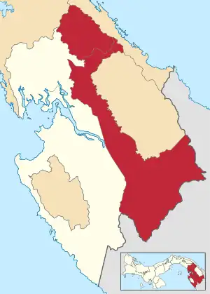 | |
 Pinogana Location of the district capital in Panama | |
| Coordinates: 8°7′48″N 77°42′36″W / 8.13000°N 77.71000°W | |
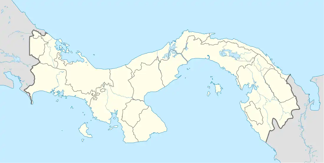
| Country | |
| Province | Darién Province |
| Capital | El Real de Santa María |
| Area | |
| • Total | 1,892 sq mi (4,901 km2) |
| Population (2019) | |
| • Total | 26,160 |
| • Density | 14/sq mi (5.3/km2) |
| official estimate[1] | |
| Time zone | UTC-5 (ETZ) |
Pinogana District (Spanish pronunciation: [pinoˈɣana]) is a district (distrito) of Darién Province in Panama. The population according to the 2000 census was 12,823;[2] the latest estimate (for 2019) is 26,160.[1] The district covers a total area of 4,901 km². The capital lies at the town of El Real de Santa María.[2]
Administrative divisions
Pinogana District is divided administratively into the following corregimientos:
Note: - The indigenous comarca of Wargandi lies within Pinogana District; although it constitutes administratively and independently as a separate corregimiento).
References
- 1 2 Instituto Nacional de Estadística y Censo, Panama.
- 1 2 "Districts of Panama". Statoids. Retrieved April 13, 2009.

This article is issued from Wikipedia. The text is licensed under Creative Commons - Attribution - Sharealike. Additional terms may apply for the media files.