Pioneer | |
|---|---|
| Other transcription(s) | |
| • Chinese | 先驱 |
| • Pinyin | Xiānqū |
| • Malay | Pioneer |
| • Tamil | பயனியர் |
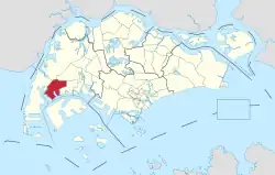 Location of Pioneer in Singapore | |
| Country | |
| Region | West
|
| Government | |
| • Mayors | South West CDC
|
| • Members of Parliament | West Coast GRC |
| Area | |
| • Total | 12.1 km2 (4.7 sq mi) |
| Population | |
| • Total | 50 |
| • Density | 4.1/km2 (11/sq mi) |
| Ethnic groups | |
Pioneer is a planning area located in the West Region of Singapore, named after Pioneer Road, formerly Jalan Besi[2]. The area is bounded by Jurong West to the north, Boon Lay to the east, Tuas to the west, the Western Water Catchment to the northwest and Selat Jurong to the south, and contains the Joo Koon, Benoi and Gul Circle industrial estates.
During the development of Jurong Industrial Estate, JTC Corporation renamed to English the Malay-named roads that ply the area, especially those near Jalan Buroh. Pioneer Road was Jalan Besi (Malay: Metal Road), while Pioneer Road North was Jalan Bandaran (Malay: Town Road) and Pioneer Circus was Bulatan Besi (Malay: Metal Circus or Metal Circle).
References
- ↑ "GE2020 results: PAP's Patrick Tay wins Pioneer SMC with 61.98% of votes over PSP and independent candidate". AsiaOne. Retrieved 11 July 2020.
- ↑ "Old map of Jurong".
.jpg)
This article is issued from Wikipedia. The text is licensed under Creative Commons - Attribution - Sharealike. Additional terms may apply for the media files.