| Planquette | |
|---|---|
  | |
| Location | |
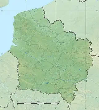
| Country | France |
| Physical characteristics | |
| Source | Pas-de-Calais |
| Mouth | Canche |
• coordinates | 50°24′17″N 1°57′19″E / 50.40472°N 1.95528°E |
| Length | 11.8 km (7.3 mi) |
| Basin features | |
| Progression | Canche→ English Channel |
The river Planquette (French pronunciation: [plɑ̃kɛt]) is one of the small streams that flow from the plateau of the southern Boulonnais and Picardy, into the Canche. Its length is 11.8 kilometres (7.3 mi).[1]
The river rises at Planques and passes Fressin, Wambercourt, Cavron-Saint-Martin and joins the Canche at Contes.
See also
References
External links
- Carte Géologique de la France à l'échelle du millionième 6th edn. BRGM (2003) ISBN 2-7159-2158-6
- Carte des bassins versants de la Canche et de la Ternoise
- Informations sur les atlas des zones inondables
This article is issued from Wikipedia. The text is licensed under Creative Commons - Attribution - Sharealike. Additional terms may apply for the media files.