Pocahontas, Mississippi | |
|---|---|
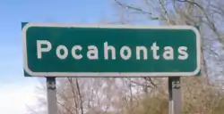 | |
 Pocahontas  Pocahontas | |
| Coordinates: 32°28′28″N 90°17′10″W / 32.47444°N 90.28611°W | |
| Country | United States |
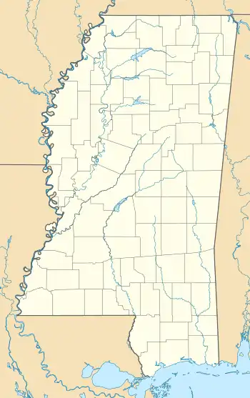
| State | Mississippi |
| County | Hinds |
| Elevation | 295 ft (90 m) |
| Time zone | UTC-6 (Central (CST)) |
| • Summer (DST) | UTC-5 (CDT) |
| ZIP code | 39072 |
| Area code | 601 |
| GNIS feature ID | 676161[1] |
Pocahontas is an unincorporated community located in northern Hinds County, Mississippi on U.S. Route 49. It is located 5 miles (8.0 km) south of Flora and 9 miles (14 km) north of Jackson and part of the Jackson Metropolitan Statistical Area. Pocahontas has a ZIP code 39072.
History
Pocahontas was founded in the 1880s, and named after Pocahontas, the Native American Indian woman.[2] Pocahontas is located on the Canadian National Railway.[3]
Two sites in Pocahontas are listed on the National Register of Historic Places: Pocahontas Mounds[4] and Sub Rosa.[5]
Notable person
- Gene Porter, jazz musician[6]
References
- ↑ U.S. Geological Survey Geographic Names Information System: Pocahontas, Mississippi
- ↑ Baca, Keith A. (2007). Native American Place Names in Mississippi. University Press of Mississippi. p. 84. ISBN 978-1-60473-483-6.
- ↑ Howe, Tony. "Pocahontas, Mississippi". Mississippi Rails. Retrieved May 19, 2021.
- ↑ "Pocahontas Mound A". Indian Mounds of Mississippi. National Park Service. Retrieved May 20, 2021.
- ↑ "National Register Information System". National Register of Historic Places. National Park Service. July 9, 2010.
- ↑ Rye, Howard (2003). "Porter, Gene [Eugene]". Grove Music Online (8th ed.). Oxford University Press. ISBN 978-1-56159-263-0. Retrieved May 19, 2021.
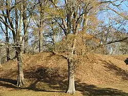
Pocahontas Mound A, located in a roadside park in Pocahontas, is listed on the National Register of Historic Places
Municipalities and communities of Hinds County, Mississippi, United States | ||
|---|---|---|
| Cities | 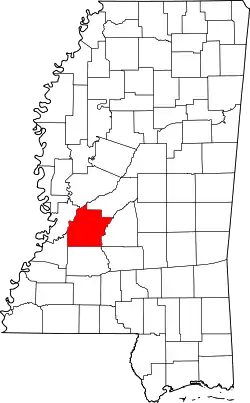 Map of Mississippi highlighting Hinds County | |
| Towns | ||
| Unincorporated communities | ||
| Footnotes | ‡ This populated place also has portions in an adjacent county or counties | |
This article is issued from Wikipedia. The text is licensed under Creative Commons - Attribution - Sharealike. Additional terms may apply for the media files.