Pogoanele | |
|---|---|
 Pogoanele Town Hall | |
 Coat of arms | |
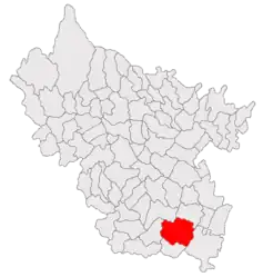 Location in Buzău County | |
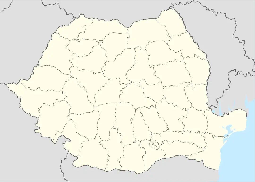 Pogoanele Location in Romania | |
| Coordinates: 44°55′N 27°0′E / 44.917°N 27.000°E | |
| Country | Romania |
| County | Buzău |
| Government | |
| • Mayor (2020–2024) | Florin Dumitrașcu[1] (PSD) |
| Area | 122 km2 (47 sq mi) |
| Elevation | 63 m (207 ft) |
| Population (2021-12-01)[2] | 6,384 |
| • Density | 52/km2 (140/sq mi) |
| Time zone | EET/EEST (UTC+2/+3) |
| Postal code | 125200 |
| Area code | (+40) 02 38 |
| Vehicle reg. | BZ |
| Website | www |
Pogoanele (Romanian pronunciation: [poˈɡo̯anele]) is a town in the southeastern part of Buzău County, Muntenia, Romania. The town administers one village, Căldărăști.
Pogoanele was declared a town in April 1989, as a result of the Romanian rural systematization program.[3] It is located in the south-central part of the county, in the middle of the Bărăgan Plain, at about 40 kilometres (25 mi) from Buzău, the county seat. It is traversed by the DN2C road, which runs from Buzău to Slobozia. The railway station (3 kilometres (1.9 mi) from the town center) is on the CFR line connecting Urziceni and Făurei.
Natives of the town include Ion A. Rădulescu-Pogoneanu and Ilie Stan.
| Year | Pop. | ±% |
|---|---|---|
| 1992 | 7,768 | — |
| 2002 | 7,795 | +0.3% |
| 2011 | 7,275 | −6.7% |
| 2021 | 6,384 | −12.2% |
| Source: Census data | ||
Notes
- ↑ "Results of the 2020 local elections". Central Electoral Bureau. Retrieved 16 June 2021.
- ↑ "Populaţia rezidentă după grupa de vârstă, pe județe și municipii, orașe, comune, la 1 decembrie 2021" (XLS). National Institute of Statistics.
- ↑ (in Romanian) Pogoanele Archived 2014-05-24 at the Wayback Machine at the Buzău County Council site
Wikimedia Commons has media related to Pogoanele.

This article is issued from Wikipedia. The text is licensed under Creative Commons - Attribution - Sharealike. Additional terms may apply for the media files.