Pohoří na Šumavě | |
|---|---|
Hamlet | |
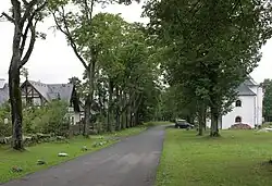 Main street | |
 Pohoří na Šumavě Location in the Czech Republic | |
| Coordinates: 48°36′13″N 14°41′47″E / 48.60361°N 14.69639°E | |
| Country | |
| Region | South Bohemian |
| District | Český Krumlov |
| Municipality | Pohorská Ves |
| First mentioned | 1524 |
| Area | |
| • Total | 26.35 km2 (10.17 sq mi) |
| Elevation | 920 m (3,020 ft) |
| Population (2021)[1] | |
| • Total | 0 |
| • Density | 0.0/km2 (0.0/sq mi) |
| Time zone | UTC+1 (CET) |
| • Summer (DST) | UTC+2 (CEST) |
| Postal code | 382 41 |
Pohoří na Šumavě (German: Buchers, Puchers) is a hamlet and administrative part of Pohorská Ves in Český Krumlov District in the South Bohemian Region of the Czech Republic. As of census 2021, it has no permanent inhabitants. It used to be a separate municipality and a regular village, which was abandoned in the 1970s.
The village was named Buchoř until 1910 and Půchoří until 1923, when it was renamed Pohoří na Šumavě.
Demographics
|
|
| ||||||||||||||||||||||||||||||||||||||||||||||||||||||
| Source: Censuses[2][1] | ||||||||||||||||||||||||||||||||||||||||||||||||||||||||
Nature protection
There are several nature monuments in the area of Pohoří na Šumavě: Myslivna, Pohořské rašeliniště, Prameniště Pohořského potoka, Stodůlecký vrch and U tří můstků.
References
- 1 2 "Výsledky sčítání 2021 – otevřená data" (in Czech). Czech Statistical Office. 21 December 2022.
- ↑ "Historický lexikon obcí České republiky 1869–2011 – Okres Český Krumlov" (in Czech). Czech Statistical Office. 21 December 2015. pp. 23–24.
External links
Wikimedia Commons has media related to Pohoří na Šumavě.
This article is issued from Wikipedia. The text is licensed under Creative Commons - Attribution - Sharealike. Additional terms may apply for the media files.