50°23′20″N 4°19′34″W / 50.389°N 4.326°W

The Halfway House

Polbathic

Polbathic
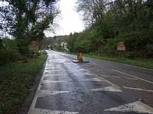
Polbathic (Cornish: Polbarthek)[1] is a small village situated on the A374 Trerulefoot to Torpoint road, within the parish of St Germans, in south-east Cornwall, England, UK. The village is situated on the edge of a tidal creek, known as Polbathick Lake, which is a branch of the River Tiddy and River Lynher river system.[2] Polbathick Lake is within the Lynher Estuary SSSI.[3][4]
References
- ↑ Place-names in the Standard Written Form (SWF) The name in Cornish seems to mean wonderful or miraculous pool, assuming the element "barthek", is not a corruption. Archived 2013-05-15 at the Wayback Machine : List of place-names agreed by the MAGA Signage Panel Archived 2013-05-15 at the Wayback Machine. Cornish Language Partnership.
- ↑ Ordnance Survey: Landranger map sheet 201 Plymouth & Launceston ISBN 978-0-319-23146-3
- ↑ "Lynher Estuary - Unit 33". Natural England. Retrieved 25 March 2014.
- ↑ "Lynher Estuary - Unit 33". Magic Map. Retrieved 25 March 2014.
External links
![]() Media related to Polbathic at Wikimedia Commons
Media related to Polbathic at Wikimedia Commons
This article is issued from Wikipedia. The text is licensed under Creative Commons - Attribution - Sharealike. Additional terms may apply for the media files.