Pollein
Polèn/Pollèn | |
|---|---|
| Comune di Pollein Commune de Pollein | |
Location of Pollein | |
 Pollein Location of Pollein in Italy 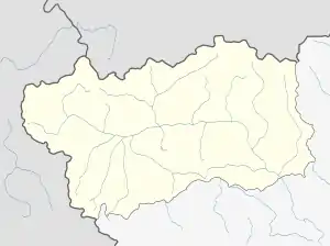 Pollein Pollein (Aosta Valley) | |
| Coordinates: 45°43′40.80″N 7°21′25.20″E / 45.7280000°N 7.3570000°E | |
| Country | Italy |
| Region | Aosta Valley |
| Province | none |
| Frazioni | Chébuillet, Rabloz, Crêtes, Dréjer, Chenaux, Chenières, Saint-Bénin, Tharençan, Moulin, Grand-Pollein, Petit Pollein, Donanche, Château, Autoport, Rongachet, Terreblanche, Tissonière |
| Area | |
| • Total | 15 km2 (6 sq mi) |
| Elevation | 551 m (1,808 ft) |
| Population (31 December 2022)[2] | |
| • Total | 1,485 |
| • Density | 99/km2 (260/sq mi) |
| Demonym | Pollençois |
| Time zone | UTC+1 (CET) |
| • Summer (DST) | UTC+2 (CEST) |
| Postal code | 11020 |
| Dialing code | 0165 |
| ISTAT code | 7049 |
| Patron saint | Saint George |
| Saint day | 23 April |
| Website | Official website |
Pollein (Valdôtain: Polèn or Pollèn) is a town and comune in the Aosta Valley region of north-western Italy.
References
- ↑ "Superficie di Comuni Province e Regioni italiane al 9 ottobre 2011". Italian National Institute of Statistics. Retrieved 16 March 2019.
- ↑ All demographics and other statistics from the Italian statistical institute (Istat)
This article is issued from Wikipedia. The text is licensed under Creative Commons - Attribution - Sharealike. Additional terms may apply for the media files.