| Porcupine Mountains Ski Area | |
|---|---|
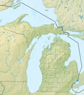
 Porcupine Mountains Ski Area Location within Michigan  Porcupine Mountains Ski Area Porcupine Mountains Ski Area (the United States) | |
| Location | Michigan, United States |
| Nearest major city | Silver City, Michigan |
| Coordinates | 46°48′N 89°40′W / 46.8°N 89.67°W |
| Vertical | 560 ft (170 m)[1] |
| Top elevation | 1,338 ft (408 m) |
| Base elevation | 911 ft (278 m) |
| Skiable area | 250 acres (1.0 km2) |
| Runs | 20 |
| Longest run | 1 mile (1.6 km) |
| Lift system | 1 triple chairlifts, 1 rope tow, 1 paddle tow[2] |
| Snowfall | 200 inches (510 cm) |
| Snowmaking | No |
| Night skiing | No |
| Website | https://porkies.ski/ |
The Porcupine Mountains Ski Area, also known as Ski the Porkies is a ski area located in the Porcupine Mountains State Park in Carp Lake Township near Silver City, Michigan, United States.[3][4][5][6] Clearing of the area began on October 18, 1940, on Weather Horn Peak and finished by January 11, 1941. After being abandoned during World War II it was reopened in December 1949.[7]
References
- ↑ "Porcupine Mountains, MI". May 14, 2021.
- ↑ "Mountain Stats". Ski The Porkies. Retrieved January 31, 2022.
- ↑ "Ski The Porkies! Porcupine Mountains Ski Area, Upper Peninsula, Michigan". Ski The Porkies. Retrieved January 30, 2022.
- ↑ "DNR - Porcupine Mountains Ski Area". www.michigan.gov. Retrieved January 30, 2022.
- ↑ hostmaster (December 29, 2016). "Porcupine Mountains Ski Area". Michigan. Retrieved January 30, 2022.
- ↑ "HuffPost Guides: Porcupine Mountains". HuffPost. January 4, 2012. Retrieved January 30, 2022.
- ↑ "History". Ski The Porkies. Retrieved January 31, 2022.
External links
This article is issued from Wikipedia. The text is licensed under Creative Commons - Attribution - Sharealike. Additional terms may apply for the media files.