| Port-au-Prince Bay | |
|---|---|
| Baie de Port-au-Prince (French) | |
 Port-au-Prince Bay | |
| Location | Gulf of Gonâve |
| Coordinates | 18°37′03″N 72°27′03″W / 18.61750°N 72.45083°W |
| River sources |
|
| Basin countries | Haiti |
| Settlements | Port-au-Prince |
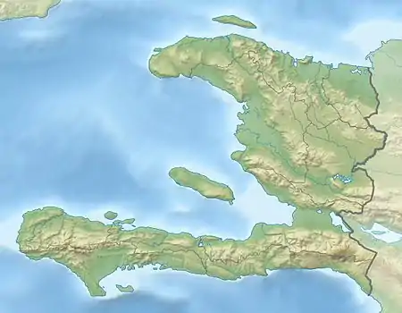
Port-au-Prince Bay is a bay located in the Gulf of Gonâve in Haiti, at the bottom of which lies the vast plain of the Cul-de-Sac and the country's capital, Port-au-Prince, alongside its metropolitan area. It is connected to the gulf via two inlets located on either side of the island of Gonâve: the Canal de Saint-Marc to the north of it and the Canal de la Gonâve to the south.
Geography
Port-au-Prince Bay extends from the Pointe de Trou Forban in the northwest to the Pointe de Cà-lra in the southwest[1] and is about 40 km (25 mi) wide and about 50 km (31 mi) long.
The Grise, Bâtarde, Froide, and Momance Rivers as well as the Boucanbrou Canal flow into Port-au-Prince Bay.
History
On 13 January 2010, in the aftermath of the 2010 Haiti earthquake, the U.S. Coast Guard cutter Forward arrived and began running air-traffic control from Port-au-Prince Bay.[2]
References
- ↑ "Le Port international de Port-au-Prince". Autorité Portuaire Nationale. Archived from the original on 3 March 2016.
- ↑ Eric Lipton (January 13, 2010). "Devastation, Seen From a Ship". The New York Times. Retrieved January 15, 2010.