Porters Neck, North Carolina | |
|---|---|
 Porters Neck, North Carolina  Porters Neck, North Carolina | |
| Coordinates: 34°17′39″N 77°46′10″W / 34.29417°N 77.76944°W | |
| Country | United States |
| State | North Carolina |
| County | New Hanover |
| Area | |
| • Total | 5.78 sq mi (14.98 km2) |
| • Land | 5.41 sq mi (14.01 km2) |
| • Water | 0.37 sq mi (0.97 km2) |
| Elevation | 20 ft (6 m) |
| Population (2020) | |
| • Total | 7,397 |
| • Density | 1,367.28/sq mi (527.87/km2) |
| Time zone | UTC-5 (Eastern (EST)) |
| • Summer (DST) | UTC-4 (EDT) |
| Area codes | 910, 472 |
| GNIS feature ID | 2584329[2] |
Porters Neck is an unincorporated community and census-designated place in New Hanover County, North Carolina, United States. Its population was 6,204 as of the 2010 census.[3]
History
William B. Gould was enslaved on Nicholas Nixon's plantation on Porters Neck before escaping in 1862.[4]
Geography
According to the U.S. Census Bureau, the community has an area of 5.708 square miles (14.78 km2); 5.365 square miles (13.90 km2) of its area is land, and 0.343 square miles (0.89 km2) is water.[3]
Demographics
| Census | Pop. | Note | %± |
|---|---|---|---|
| 2020 | 7,397 | — | |
| U.S. Decennial Census[5] | |||
References
- ↑ "ArcGIS REST Services Directory". United States Census Bureau. Retrieved September 20, 2022.
- 1 2 U.S. Geological Survey Geographic Names Information System: Porters Neck, North Carolina
- 1 2 "2010 Census Gazetteer Files - Places: North Carolina". U.S. Census Bureau. Retrieved February 26, 2017.
- ↑ Gould IV, William B. (2002). Diary of a Contraband: The Civil War Passage of a Black Sailor (paperback ed.). Stanford University Press. p. 38. ISBN 0-8047-4708-3.
- ↑ "Census of Population and Housing". Census.gov. Retrieved June 4, 2016.
Municipalities and communities of New Hanover County, North Carolina, United States | ||
|---|---|---|
| City | 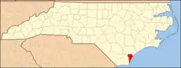 | |
| Towns | ||
| CDPs | ||
| Unincorporated community | ||
| Former communities | ||
This article is issued from Wikipedia. The text is licensed under Creative Commons - Attribution - Sharealike. Additional terms may apply for the media files.