| Portington | |
|---|---|
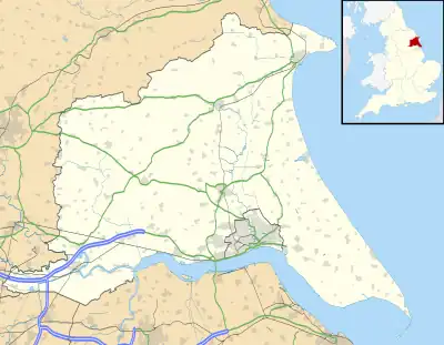
 Portington Location within the East Riding of Yorkshire | |
| OS grid reference | SE787309 |
| Civil parish | |
| Unitary authority | |
| Ceremonial county | |
| Region | |
| Country | England |
| Sovereign state | United Kingdom |
| Post town | GOOLE |
| Postcode district | DN14 |
| Dialling code | 01430 |
| Police | Humberside |
| Fire | Humberside |
| Ambulance | Yorkshire |
| UK Parliament | |
Portington is a hamlet in the East Riding of Yorkshire, England. It is situated approximately 3 miles (5 km) east of Howden and lies 0.5 miles (0.8 km) east of the A614 road.

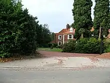
Portington Hall
It forms part of the civil parish of Eastrington. Portington lies within the Parliamentary constituency of Haltemprice and Howden an area that mainly consists of middle class suburbs, towns and villages. The area is affluent and has one of the highest proportions of owner-occupiers in the country.[1]
Portington Hall is a Grade II listed building.[2]
References
- ↑ "Haltemprice and Howden". UK Polling Report. Retrieved 11 May 2015.
- ↑ Historic England. "Portington Hall (1083336)". National Heritage List for England. Retrieved 25 February 2015.
- Gazetteer — A–Z of Towns Villages and Hamlets. East Riding of Yorkshire Council. 2006. p. 9.
External links
Wikimedia Commons has media related to Portington.
- Portington in the Domesday Book
This article is issued from Wikipedia. The text is licensed under Creative Commons - Attribution - Sharealike. Additional terms may apply for the media files.