| Portneuf Range | |
|---|---|
| Highest point | |
| Peak | Bonneville Peak |
| Elevation | 2,826 m (9,272 ft) |
| Geography | |
| Country | United States |
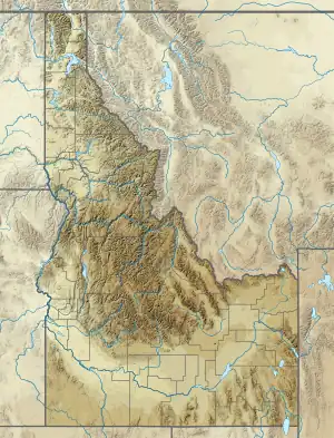
| State | Idaho |
| District | Caribou, Franklin, and Bannock counties |
| Range coordinates | 42°52′00″N 112°11′00″W / 42.86667°N 112.18333°W |
| Topo map | USGS Preston |
The Portneuf Range is a small mountain range in Caribou, Franklin, and Bannock counties in Idaho, United States.[1]
Description
The range is bounded by the Bear River Range on the east and the Bannock Range on the west.[2][3] The highest point in the range is Bonneville Peak, at 9,271 feet (2,826 m).[4]
U.S. Route 30 runs east–west through the middle of the range.
See also
References
- 1 2 U.S. Geological Survey Geographic Names Information System: Portneuf Range
- ↑ "Pocatello" (Map). usgs.gov. 1:250000. United States Geological Survey. 1983. Retrieved August 5, 2023.
- ↑ "Preston" (Map). usgs.gov. 1:100000. United States Geological Survey. 1983. Retrieved August 5, 2023.
- ↑ "Portneuf Range". Peakbagger.com. Retrieved August 8, 2023.
External links
![]() Media related to Portneuf Mountains at Wikimedia Commons
Media related to Portneuf Mountains at Wikimedia Commons
This article is issued from Wikipedia. The text is licensed under Creative Commons - Attribution - Sharealike. Additional terms may apply for the media files.