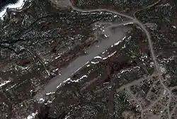
Postville Airport | |||||||||||
|---|---|---|---|---|---|---|---|---|---|---|---|
 | |||||||||||
| Summary | |||||||||||
| Airport type | Public | ||||||||||
| Operator | Government of Newfoundland and Labrador | ||||||||||
| Location | Postville, Newfoundland and Labrador | ||||||||||
| Time zone | AST (UTC−04:00) | ||||||||||
| • Summer (DST) | ADT (UTC−03:00) | ||||||||||
| Elevation AMSL | 223 ft / 68 m | ||||||||||
| Coordinates | 54°54′37″N 059°47′07″W / 54.91028°N 59.78528°W | ||||||||||
| Map | |||||||||||
 CCD4 Location in Newfoundland and Labrador | |||||||||||
| Runways | |||||||||||
| |||||||||||
Source: Canada Flight Supplement[1] | |||||||||||
Postville Airport (IATA: YSO, TC LID: CCD4) is located adjacent to Postville, Newfoundland and Labrador, Canada.
Airlines and destinations
| Airlines | Destinations |
|---|---|
| PAL Airlines | Goose Bay, Hopedale, Makkovik, Nain, Natuashish, Rigolet[2] |
References
- ↑ Canada Flight Supplement. Effective 0901Z 16 July 2020 to 0901Z 10 September 2020.
- ↑ "Air Labrador Route Map". Archived from the original on 2017-03-02. Retrieved 2017-03-01.
External links
This article is issued from Wikipedia. The text is licensed under Creative Commons - Attribution - Sharealike. Additional terms may apply for the media files.