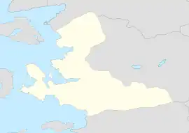
Poyracık | |
|---|---|
 Poyracık Location in Turkey  Poyracık Poyracık (İzmir) | |
| Coordinates: 39°05′N 27°21′E / 39.083°N 27.350°E | |
| Country | Turkey |
| Province | İzmir |
| District | Kınık |
| Elevation | 60 m (200 ft) |
| Population (2022) | 5,990 |
| Time zone | TRT (UTC+3) |
| Postal code | 35990 |
| Area code | 0232 |
Poyracık is a neighbourhood in the municipality and district of Kınık, İzmir Province, Turkey.[1] Its population is 5,990 (2022).[2] Before the 2013 reorganisation, it was a town (belde).[3][4] It is very close to Kınık. Distance to İzmir is about 140 kilometres (87 mi).
Poyracık is an old town and its history can be traced back to Gambrion of the 4th century BC. It was an important settlement during Pergamon state. In the middle age it became a part of Byzantine Empire. Sasa bey (a Turkmen bey of Aydınoğlu beylik) captured the town and finally it became a part of the Ottoman Empire. In 1937 it was declared a seat of township.[5]
References
- ↑ Mahalle, Turkey Civil Administration Departments Inventory. Retrieved 12 July 2023.
- ↑ "Address-based population registration system (ADNKS) results dated 31 December 2022, Favorite Reports" (XLS). TÜİK. Retrieved 12 July 2023.
- ↑ "Law No. 6360". Official Gazette (in Turkish). 6 December 2012.
- ↑ "Classification tables of municipalities and their affiliates and local administrative units" (DOC). Official Gazette (in Turkish). 12 September 2010.
- ↑ Mayor’s page (in Turkish) Archived 2012-09-06 at archive.today
This article is issued from Wikipedia. The text is licensed under Creative Commons - Attribution - Sharealike. Additional terms may apply for the media files.