Prairieton Township | |
|---|---|
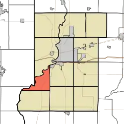 Location in Vigo County | |
| Coordinates: 39°21′33″N 87°30′11″W / 39.35917°N 87.50306°W | |
| Country | United States |
| State | Indiana |
| County | Vigo |
| Government | |
| • Type | Indiana township |
| Area | |
| • Total | 18.51 sq mi (47.9 km2) |
| • Land | 17.83 sq mi (46.2 km2) |
| • Water | 0.68 sq mi (1.8 km2) 3.67% |
| Elevation | 459 ft (140 m) |
| Population (2010) | |
| • Total | 1,222 |
| • Density | 68.6/sq mi (26.5/km2) |
| ZIP codes | 47870 |
| GNIS feature ID | 453775 |
Prairieton Township is one of twelve townships in Vigo County, Indiana, United States. As of the 2010 census, its population was 1,222 and it contained 517 housing units.[1]
Geography
According to the 2010 census, the township has a total area of 18.51 square miles (47.9 km2), of which 17.83 square miles (46.2 km2) (or 96.33%) is land and 0.68 square miles (1.8 km2) (or 3.67%) is water.[1]
Cities, towns, villages
- Terre Haute (west edge)
Unincorporated communities
Adjacent townships
- Sugar Creek Township (north)
- Honey Creek Township (east)
- Linton Township (southeast)
- Prairie Creek Township (southwest)
- Darwin Township, Clark County, Illinois (west)
- Wabash Township, Clark County, Illinois (northwest)
Cemeteries
The township contains New Harmony Cemetery.
Airports and landing strips
- Higginbotham Field
Landmarks
- Federal Bureau of Prisons Terre Haute Penitentiary (west edge)
School districts
Political districts
- Indiana's 8th congressional district
- State House District 45
- State Senate District 39
Municipal
- Praireton/Prairie Creek Fire Protection District
- The Fire Departments from Prairieton Township and Prairie Creek Township merged to form a Fire Protection District on August 16, 2007.
References
- United States Census Bureau 2007 TIGER/Line Shapefiles
- United States Board on Geographic Names (GNIS)
- IndianaMap
- 1 2 "Population, Housing Units, Area, and Density: 2010 - County -- County Subdivision and Place -- 2010 Census Summary File 1". United States Census. Archived from the original on February 10, 2020. Retrieved May 10, 2013.
External links
Municipalities and communities of Vigo County, Indiana, United States | ||
|---|---|---|
| City | Map of Indiana highlighting Vigo County | |
| Towns | ||
| Townships | ||
| CDPs | ||
| Other communities |
| |
| Footnotes | ‡This populated place also has portions in an adjacent county or counties | |
This article is issued from Wikipedia. The text is licensed under Creative Commons - Attribution - Sharealike. Additional terms may apply for the media files.