Preemption Township | |
|---|---|
Township | |
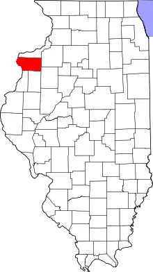
 Location in Mercer County | |
 Mercer County's location in Illinois | |
| Country | United States |
| State | Illinois |
| County | Mercer |
| Established | November 8, 1853 |
| Area | |
| • Total | 36.88 sq mi (95.5 km2) |
| • Land | 36.85 sq mi (95.4 km2) |
| • Water | 0.03 sq mi (0.08 km2) 0.08% |
| Population (2010) | |
| • Estimate (2016)[1] | 1,683 |
| • Density | 48.4/sq mi (18.7/km2) |
| Time zone | UTC-6 (CST) |
| • Summer (DST) | UTC-5 (CDT) |
| FIPS code | 17-131-61795 |
Preemption Township is located in Mercer County, Illinois. As of the 2010 census, its population was 1,783 and it contained 737 housing units.[2] Preemption Township changed its name from Fairfield Township sometime before 1921.
Geography
According to the 2010 census, the township has a total area of 36.88 square miles (95.5 km2), of which 36.85 square miles (95.4 km2) (or 99.92%) is land and 0.03 square miles (0.078 km2) (or 0.08%) is water.[2]
Demographics
| Census | Pop. | Note | %± |
|---|---|---|---|
| 2016 (est.) | 1,683 | [1] | |
| U.S. Decennial Census[3] | |||
References
- 1 2 "Population and Housing Unit Estimates". Retrieved June 9, 2017.
- 1 2 "Population, Housing Units, Area, and Density: 2010 - County -- County Subdivision and Place -- 2010 Census Summary File 1". United States Census. Archived from the original on February 12, 2020. Retrieved May 28, 2013.
- ↑ "Census of Population and Housing". Census.gov. Retrieved June 4, 2016.
External links
Municipalities and communities of Mercer County, Illinois, United States | ||
|---|---|---|
| Cities | Map of Illinois highlighting Mercer County | |
| Villages | ||
| Townships | ||
| CDPs | ||
| Other communities | ||
| Footnotes | ‡This populated place also has portions in an adjacent county or counties | |
41°17′04″N 90°36′36″W / 41.28444°N 90.61000°W
This article is issued from Wikipedia. The text is licensed under Creative Commons - Attribution - Sharealike. Additional terms may apply for the media files.