Route 4 | ||||
|---|---|---|---|---|
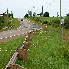
 Route 4 near Cardigan | ||||
| Route information | ||||
| Maintained by Transportation and Public Works | ||||
| Length | 64.9 km[1] (40.3 mi) | |||
| Major junctions | ||||
| South end | ||||
| ||||
| North end | ||||
| Location | ||||
| Country | Canada | |||
| Province | Prince Edward Island | |||
| Counties | Kings, Queens | |||
| Highway system | ||||
|
| ||||
| ||||
Route 4 is a 63 km (39 mi) long, two-lane uncontrolled access secondary highway in eastern Prince Edward Island, Canada. In runs east from the Trans-Canada Highway (Route 1) at Wood Islands along the Northumberland Straight to Route 18 the settlement of High Bank, where it turns north and passes through Murray River and Montague before ending at Route 2 at Dingwells Mills.[2] Its maximum speed limit is 90 km/h (56 mph).[3]
Route 4 is designated an arterial highway for approximately 30 kilometres (19 mi) from Route 2 in Dingwells Mills to Route 17 in Montague; the remainder is designated a collector highway.[4]
Names
Route 4 has several local names:[2]
- Shore Road (Wood Islands to High Bank)
- Normans Road (High Bank to Murray River)
- Commercial Road (Murray River to Montague)
- A.A. Macdonald Highway (Montague to Pooles Corner)
- Alleys Mill Road (Pooles Corner to Cardigan)
- Seven Mile Road (Cardigan to Dundas)
- Dundas Road (Dundas to Dingwells Mills)
Major intersections
From south to north:[2]
| County | Location | km[1] | mi | Destinations | Notes |
|---|---|---|---|---|---|
| Queens | Wood Islands | 0.0 | 0.0 | Southern terminus | |
| | 6.1 | 3.8 | |||
| Kings | High Bank | 10.8 | 6.7 | ||
| | 12.4 | 7.7 | |||
| Murray River | 17.1 | 10.6 | Signed as Route 18 west but heads east[5] | ||
| 17.6 | 10.9 | Intersections offset, 30 m (100 ft) concurrency | |||
| 17.9 | 11.1 | ||||
| 18.3 | 11.4 | Roundabout | |||
| | 19.1 | 11.9 | |||
| Alliston | 23.3 | 14.5 | |||
| St. Marys Road | 26.1 | 16.2 | |||
| Milltown Cross | 28.4 | 17.6 | |||
| Commercial Cross | 31.2 | 19.4 | Intersections offset, 40 m (130 ft) concurrency | ||
| Montague | 33.9 | 21.1 | |||
| 34.6 | 21.5 | Roundabout | |||
| 35.4 | 22.0 | ||||
| 35.7 | 22.2 | ||||
| 36.2 | 22.5 | ||||
| 36.8 | 22.9 | ||||
| | 39.4 | 24.5 | |||
| 40.0 | 24.9 | ||||
| Pooles Corner | 41.0 | 25.5 | Roundabout | ||
| | 44.2 | 27.5 | |||
| 44.5 | 27.7 | ||||
| 45.5 | 28.3 | ||||
| 46.6 | 29.0 | South end of Route 321 concurrency | |||
| 47.1 | 29.3 | North end of Route 321 concurrency | |||
| Primrose | 54.4 | 33.8 | |||
| 54.8 | 34.1 | ||||
| Bridgetown | 56.4 | 35.0 | |||
| Dundas | 58.1 | 36.1 | |||
| 58.4 | 36.3 | ||||
| Albion Cross | 60.7 | 37.7 | |||
| Dingwell Mills | 64.9 | 40.3 | Northern terminus | ||
1.000 mi = 1.609 km; 1.000 km = 0.621 mi
| |||||
References
- 1 2 Google Maps (Map). Google. Retrieved September 25, 2019.
- 1 2 3 Prince Edward Island Transportation and Infrastructure Renewal (2014). Provincial Road Atlas - Prince Edward Island (PDF) (Map). 1:50,000. Government of Prince Edward Island. pp. 36–39, 41–42. Retrieved September 12, 2019.
- ↑ "Watch Your Speed: PEI Gets Radar Cameras". Canada MotoGuide. 9 June 2023. Retrieved 19 October 2023.
- ↑ "Roads Act: Highway Access Regulations". Chapter R-15, Act of 20 September 2016. Retrieved 11 November 2016.
- ↑ Google (September 24, 2019). "Route 4/18 (north intersection)" (Map). Google Maps. Google. Retrieved September 24, 2019.
This article is issued from Wikipedia. The text is licensed under Creative Commons - Attribution - Sharealike. Additional terms may apply for the media files.
