 | ||||
|---|---|---|---|---|
| 台31線 | ||||
 | ||||
| Route information | ||||
| Maintained by Directorate General of Highways | ||||
| Length | 30.036 km[1] (18.664 mi) | |||
| Major junctions | ||||
| North end | ||||
| South end | ||||
| Location | ||||
| Country | Taiwan | |||
| Highway system | ||||
| ||||
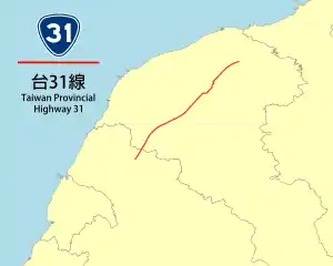
Provincial Highway 31 (Chinese: 台31線) is a 30.036-kilometre-long (18.664-mile) provincial highway in Taoyuan City, Taiwan. An elevated section of the Taiwan High Speed Rail viaduct and under-tunnel acts as a median for most of the highway, except when the highway is near THSR Taoyuan Station and when the highway is near and on its southern terminus.[2] The highway serves the THSR Taoyuan Station.
Major intersections
| County | Location | km[2] | mi | Destinations | Notes |
|---|---|---|---|---|---|
| Luzhu | 0.0 | 0.0 | |||
| 0.75 | 0.47 | TR 15 (Fuguo Road) – Shuiwei, Zhuwei, Taoyuan District | |||
| 2.1 | 1.3 | TR 19 (Fuhua Road) – Dahua, Luzhu Village | |||
| 4.8 | 3.0 | Exit 5 (Dazhu Interchange) on Fwy. 2 | |||
| 4.8 | 3.0 | Northbound exit and southbound entrance | |||
| Dayuan | 5.7 | 3.5 | |||
| Zhongli | 8.8 | 5.5 | North end of CR 113C concurrency | ||
| 9.3 | 5.8 | South end of CR 113C concurrency | |||
| 10.6 | 6.6 | ||||
| 11.8 | 7.3 | TR 43-1 (Shengde Road) – Zhongli, Dayuan | |||
| 12.9 | 8.0 | ||||
| Zhongli–Xinwu border | 16.5 | 10.3 | |||
| Xinwu | 17.9 | 11.1 | At-grade intersection | ||
1.000 mi = 1.609 km; 1.000 km = 0.621 mi
| |||||
References
- ↑ "Provincial Highway Mileage Table". Directorate General of Highways. Retrieved 27 March 2014.
- 1 2 Google (27 March 2014). "Provincial Highway 31 (Taiwan)" (Map). Google Maps. Google. Retrieved 27 March 2014.
External links
Template:Attached KML/Provincial Highway 31 (Taiwan)
KML is from Wikidata
This article is issued from Wikipedia. The text is licensed under Creative Commons - Attribution - Sharealike. Additional terms may apply for the media files.