Highway 124 | ||||
|---|---|---|---|---|
| Ruta 124 | ||||
| Route information | ||||
| Maintained by Puerto Rico DTPW | ||||
| Length | 26.8 km[1] (16.7 mi) | |||
| Existed | 1953[2]–present | |||
| Major junctions | ||||
| West end | ||||
| ||||
| East end | ||||
| Location | ||||
| Country | United States | |||
| Territory | Puerto Rico | |||
| Municipalities | Las Marías, San Sebastián, Lares | |||
| Highway system | ||||
| ||||


Puerto Rico Highway 124 (PR-124) is a rural road that connects from Lares to Las Marías.[3]
Route description
It is a curvy road, which crosses the Río Grande de Añasco in barrio Espino (between Lares and Las Marías). Among its intersections are PR-111 (in Lares), PR-120 (to Maricao) and PR-119.[4]
 PR-435 at its junction with PR-124
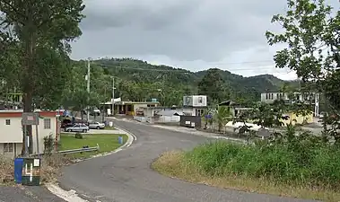 Puerto Rico Highway 124
Major intersections
| Municipality | Location | km[1] | mi | Destinations | Notes | |||
|---|---|---|---|---|---|---|---|---|
| Las Marías | Las Marías barrio-pueblo | 0.0 | 0.0 | Western terminus of PR-124 | ||||
| 0.1 | 0.062 | |||||||
| Palma Escrita–Buena Vista line | 6.8 | 4.2 | ||||||
| Cerrote | 10.8– 10.9 | 6.7– 6.8 | ||||||
| 12.8 | 8.0 | |||||||
| Lares | Pezuela | 16.3 | 10.1 | |||||
| Las Marías |
No major junctions | |||||||
| San Sebastián |
No major junctions | |||||||
| Lares | Espino | 21.5 | 13.4 | |||||
| 23.7 | 14.7 | |||||||
| Espino–La Torre line | 24.2– 24.3 | 15.0– 15.1 | ||||||
| Pueblo | 26.6– 26.7 | 16.5– 16.6 | ||||||
| Pueblo–Lares barrio-pueblo line | 26.8 | 16.7 | Eastern terminus of PR-124 | |||||
| 1.000 mi = 1.609 km; 1.000 km = 0.621 mi | ||||||||
See also
References
- 1 2 Google (3 March 2020). "PR-124" (Map). Google Maps. Google. Retrieved 3 March 2020.
- ↑ "Lares, Memoria Núm. 60" (PDF). Puerto Rico Planning Board (in Spanish). 1955. Retrieved 4 August 2020.
- ↑ "Tránsito Promedio Diario (AADT)". Transit Data (Datos de Transito) (in Spanish). DTOP PR. p. 72. Archived from the original on 1 April 2019.
- ↑ National Geographic Maps (2011). Puerto Rico (Map). 1:125,000. Adventure Map (Book 3107). Evergreen, Colorado: National Geographic Maps. ISBN 978-1566955188. OCLC 756511572.
External links
 Media related to Puerto Rico Highway 124 at Wikimedia Commons
This article is issued from Wikipedia. The text is licensed under Creative Commons - Attribution - Sharealike. Additional terms may apply for the media files.